
Hello Team,
I am try to use Clipper function in Python API for Raster.
When i run my Workspace a crash is happen:
Attached my Workspace.
Thanks in Advance,


 +45
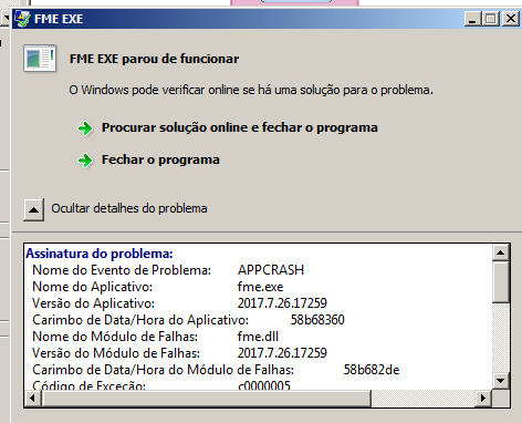
+45Hello Team,
I am try to use Clipper function in Python API for Raster.
When i run my Workspace a crash is happen:
Attached my Workspace.
Thanks in Advance,
Enter your E-mail address. We'll send you an e-mail with instructions to reset your password.


