Hi, I have a 3D Microstation v8 DGN file which I need to convert to shapefile. How do i get the elevation data out of the DGN and into an attribute field in the shapefile?
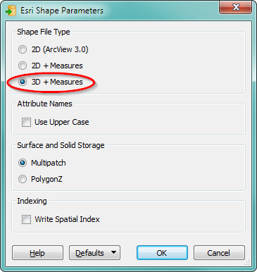
Normally, 3D data is written to ESRI Shape by FME normally, as long as the shape feature type supports it (polylinez, polygonz, pointz, etc).
However, this is written into the geometric data of the feature, not saved as an attribute.
To save elevation to an attribute, you need to use a transformer such as ElevationExtractor to create an attibute containing the information within FME. Then link that attribute to a user attribute in the output feature type of your writer.
If you want to expose the Z of the 3D dgn elements there are many to chose from in the native filetype.
Elevation extractor* will work nicely in your workflow, but there is another way. You can also expose them in the format attributes of feature type properties.
right click your dgn reader in workbench, feature type properties, format attributes, in search box type Z, and you'll have the list shortened for you.
igds_insertion_Z*, igds_zhigh, igds_zlow
are a few of the highlights I would look at exposing if you want the Z-ness exposed as available attribute in your outbound filetype, **igds_date_last_modified is also very handy if you need to version datestamp for your gis data.
We use 3 different kinds of cookies. You can choose which cookies you want to accept. We need basic cookies to make this site work, therefore these are the minimum you can select. Learn more about our cookies.

 +1
+1