Hi guys,
I have 02 shapefiles (point and line), I want to find the nearest line for each point [relation 1 (line) to many (point)] inside a diameter of 15m and to find the relative position of those points.
Thanks for help

Hi guys,
I have 02 shapefiles (point and line), I want to find the nearest line for each point [relation 1 (line) to many (point)] inside a diameter of 15m and to find the relative position of those points.
Thanks for help
Best answer by takashi
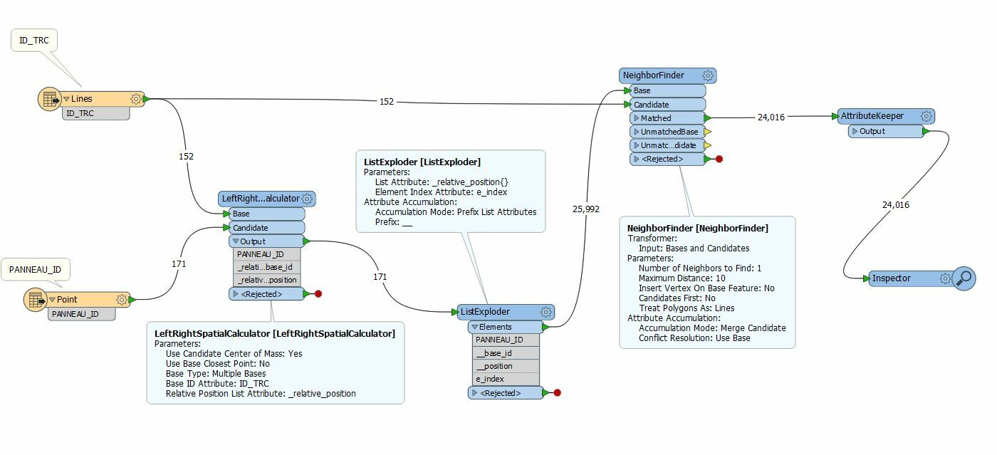
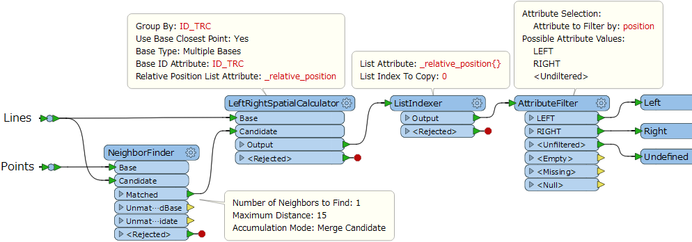
Hi @messaoud2010net, if I understand the requirement correctly, this workflow might help you. Assuming that "ID_TRC" is an attribute which can be used to identify each line uniquely.
Enter your E-mail address. We'll send you an e-mail with instructions to reset your password.


")


