


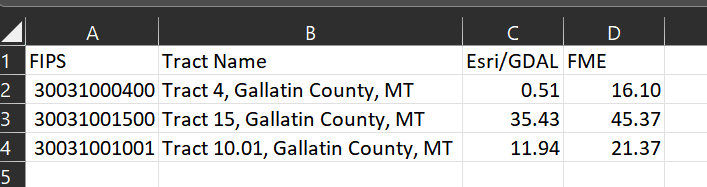
I'm trying to replicate an analysis in FME that we have done both Esri and GDAL Zonal Stats tools. It is pretty basic. I have a single band raster layer of percent tree cover spanning the contiguous US. I need to summarize that data at the tract level. I.e. what is the mean tree cover for each tract within the US. I get identical results when doing the analysis with Zonal Statistics in Esri and GDAL. When I conduct a similar analysis in FME by clipping the raster to the tracts (merging attributes) and then use the RasterStatisticsCalculator on the result, I get a completely different answer.


 Also, here is a screen shot of the process I'm using. I was wondering if I might need to change Preserve Clippee Extents to Yes, but it takes over 3 hours to run just those 3 tracts, so I gave up on that process. I need to process 84,122 tracts, so over 1 hour/tract will not be practical. Thanks for taking a peek.
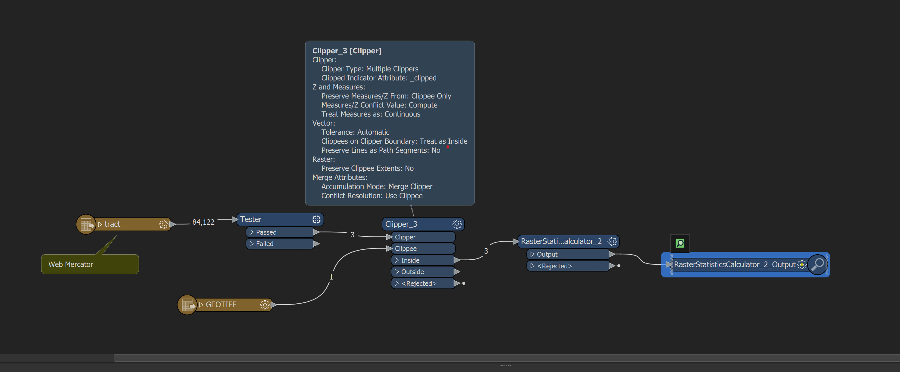


Reply
Rich Text Editor, editor1
Editor toolbars
Press ALT 0 for help
Helpful Members This Week


Enter your E-mail address. We'll send you an e-mail with instructions to reset your password.