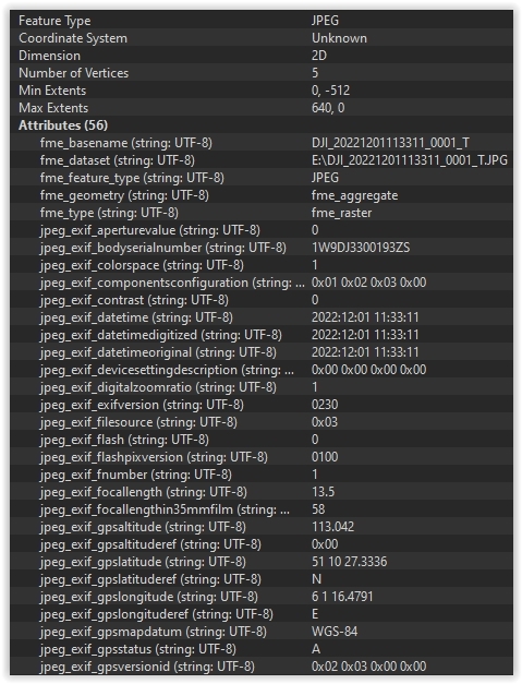
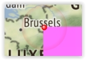
Can you post a screenshot of the EXIF information you're getting?
Just as I thought, the latitude/longitude are given in WGS84, degrees, minutes and (decimal) seconds. You need to use an AttributeSplitter, with a space as separator character, first to separate them into list elements and then a DecimalDegreesCalculator to turn them into decimal degrees.
Then an Offsetter or Georeferencer to turn your jpg into a georeferenced one (although if it's supposed to be a top-down photo and the drone wasn't completely level when the photo was taken that might be a whole other ordeal).
Can you post a screenshot of the EXIF information you're getting?
Do you have more information in the exif data? I see an altitude in there as well, along with the focal length that should tell you something about the size of the image on the ground, but even then I think that's not quite enough yet.
Can you post a screenshot of the EXIF information you're getting?
I think it's better if you post them here so that others can try and help you. I'm not sure I have the answers for you (as we're getting into photogrammetry here and that's not my strong side), nor the time what with the holidays.
In addition to that, if somebody here provides the correct answer and others find this thread later on they might be helped by it too.
We use 3 different kinds of cookies. You can choose which cookies you want to accept. We need basic cookies to make this site work, therefore these are the minimum you can select. Learn more about our cookies.