Hi All,
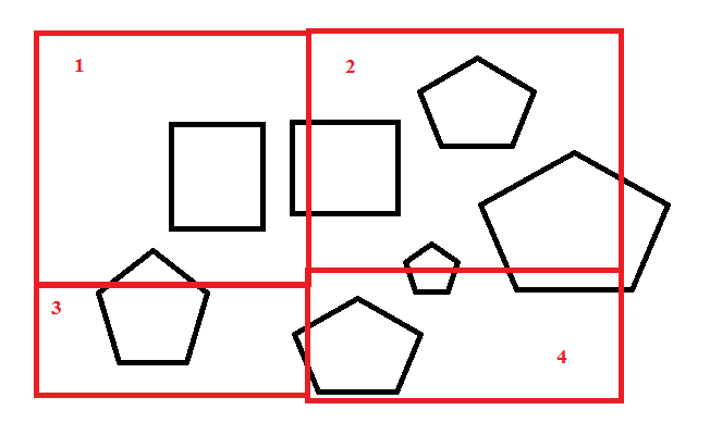
I am having grid (red) polygons as shown below and I want to update Grid id to other polygons (black) when it covers maximum portion in that grid. Can any one suggest how it can be achieved in FME.
Thanks,
Ram.

Hi All,
I am having grid (red) polygons as shown below and I want to update Grid id to other polygons (black) when it covers maximum portion in that grid. Can any one suggest how it can be achieved in FME.
Thanks,
Ram.
Best answer by deanhowell
Hello again @kumarbangaram
Here is a suggestion for your requirements. I created some test data as I could get your test data to display correctly.
The Counters add the ID for each polygon in both Grid and Shapes.
The AreaOnAreaOverlayer intersects the two datasets.
The Tester removes the open space and any shapes that don't intersect.
The AreaCalculator then calculates the intersected areas.
The SpatialRelator then used to create the list
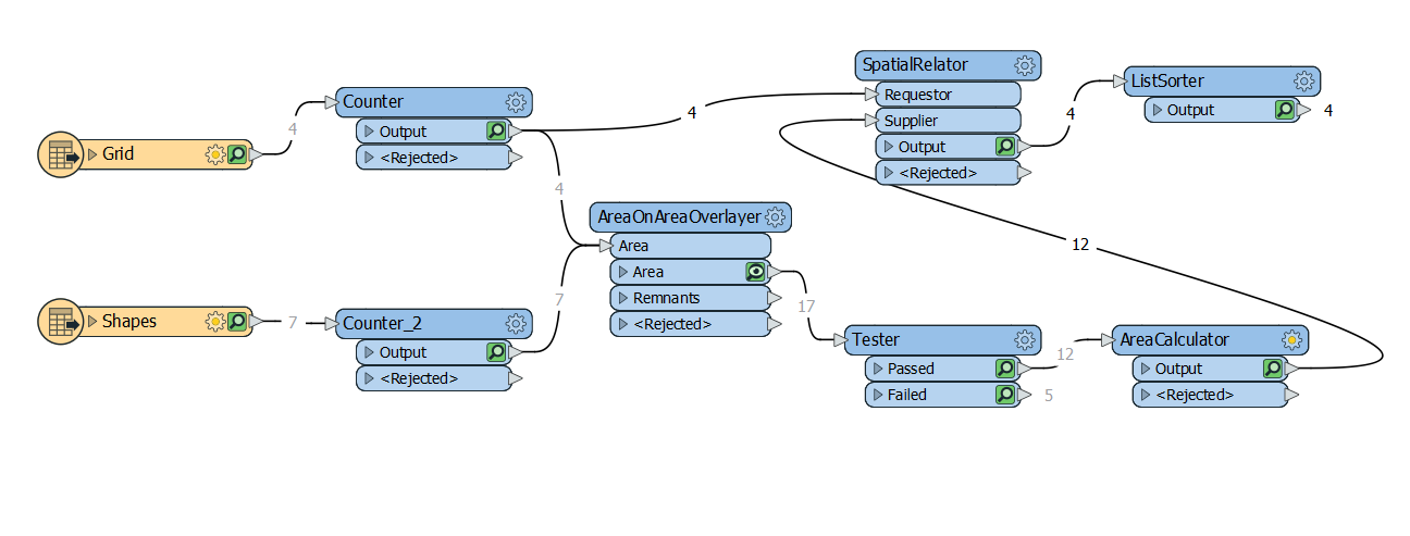
The ListSorter is used to sort based on area and then the first element in the list will be the one with the largest area. Hope this helps.
Enter your E-mail address. We'll send you an e-mail with instructions to reset your password.


