How can i get the data from this website via fme
https://idpgis.ncep.noaa.gov/arcgis/rest/services/NWS_Forecasts_Guidance_Warnings/NHC_tropical_weather_summary/MapServer/1
Use the "Esri ArcGIS Server Feature Service" FeatureReader or Reader.
Put
https://idpgis.ncep.noaa.gov/arcgis/rest/services/NWS_Forecasts_Guidance_Warnings/NHC_tropical_weather_summary/MapServer
in the dataset field and choose the layers under Feature Types To Read (FeatureReader) or Parameters (Reader).
Hi @asadamjad
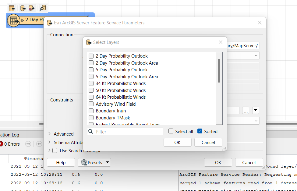
You can get to these features using the Esri ArcGIS Server Feature Service reader but you have to update the URL just a little:
https://idpgis.ncep.noaa.gov/arcgis/rest/services/NWS_Forecasts_Guidance_Warnings/NHC_tropical_weather_summary/MapServer/
After you select the layer that you want to explore:
Attached the Workspace. Please - check if is the layer that you want to explore.
Thanks in Advance,
Danilo
13 votes
8 votes
7 votes
6 votes
5 votes
4 votes
3 votes
Already have an account? Login
Enter your E-mail address. We'll send you an e-mail with instructions to reset your password.
Sorry, we're still checking this file's contents to make sure it's safe to download. Please try again in a few minutes.
Sorry, our virus scanner detected that this file isn't safe to download.
We use cookies to enhance and personalize your experience. If you accept you agree to our full cookie policy. Learn more about our cookies.
We use 3 different kinds of cookies. You can choose which cookies you want to accept. We need basic cookies to make this site work, therefore these are the minimum you can select. Learn more about our cookies.

 +5
+5