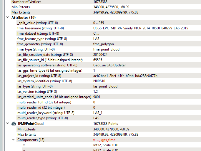
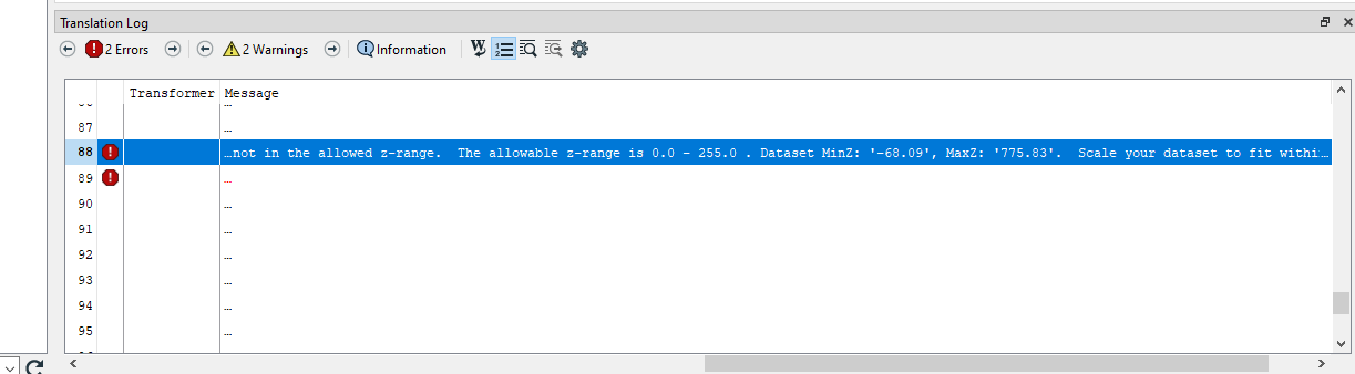
Hello, I'm experiencing difficulty transforming a .las file to Mojang Minecraft format, as I receive an error stating that the Z coordinates exceed the allowed parameters (0-255). I've found no straightforward way to manually set the maximums and minimums before transforming. I've tried to scale the .las, but the feature is imprecise and results in distorted structures. Is there a way to set minimum and maximum coordinates prior to transforming?

Solved
Set Maximum and Minimum Coordinates
Best answer by danminneyatsaf
shibboleth wrote:
Hi @danminneyatsaf, thank you for the reply! I attempted this, and it appeared the point cloud was processed successfully by the splitter; However, there was nothing output from the tester.
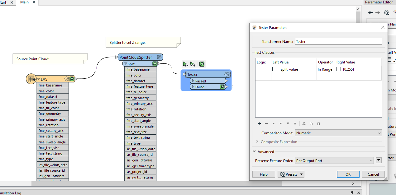
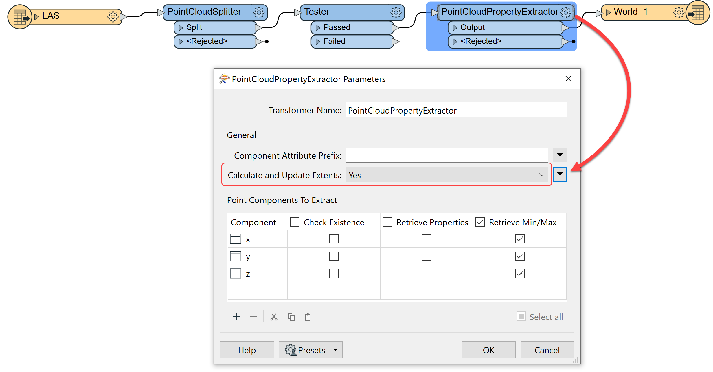
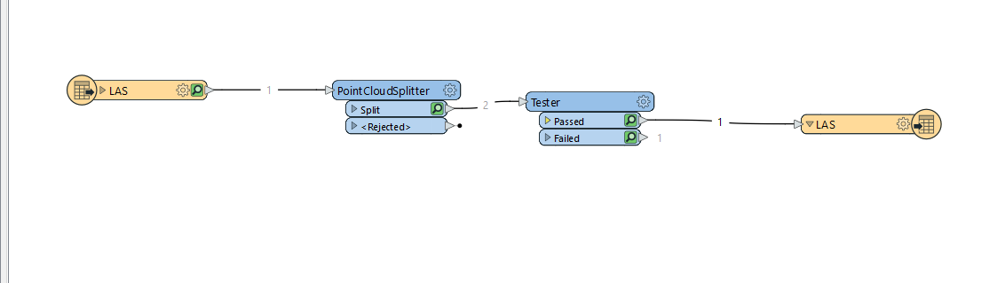
@shibboleth you can insert it right after the Tester. I made an edit above in my previous comment mentioning that you'll need to change the Calculate and Update Extents parameter in the PointCloudPropertyExtractor to Yes. I've attached a sample workspace to this reply for reference.


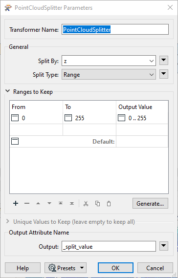 Next, use a Tester transformer to filter out only the feature that have a _split_value of 0' .. 255'.
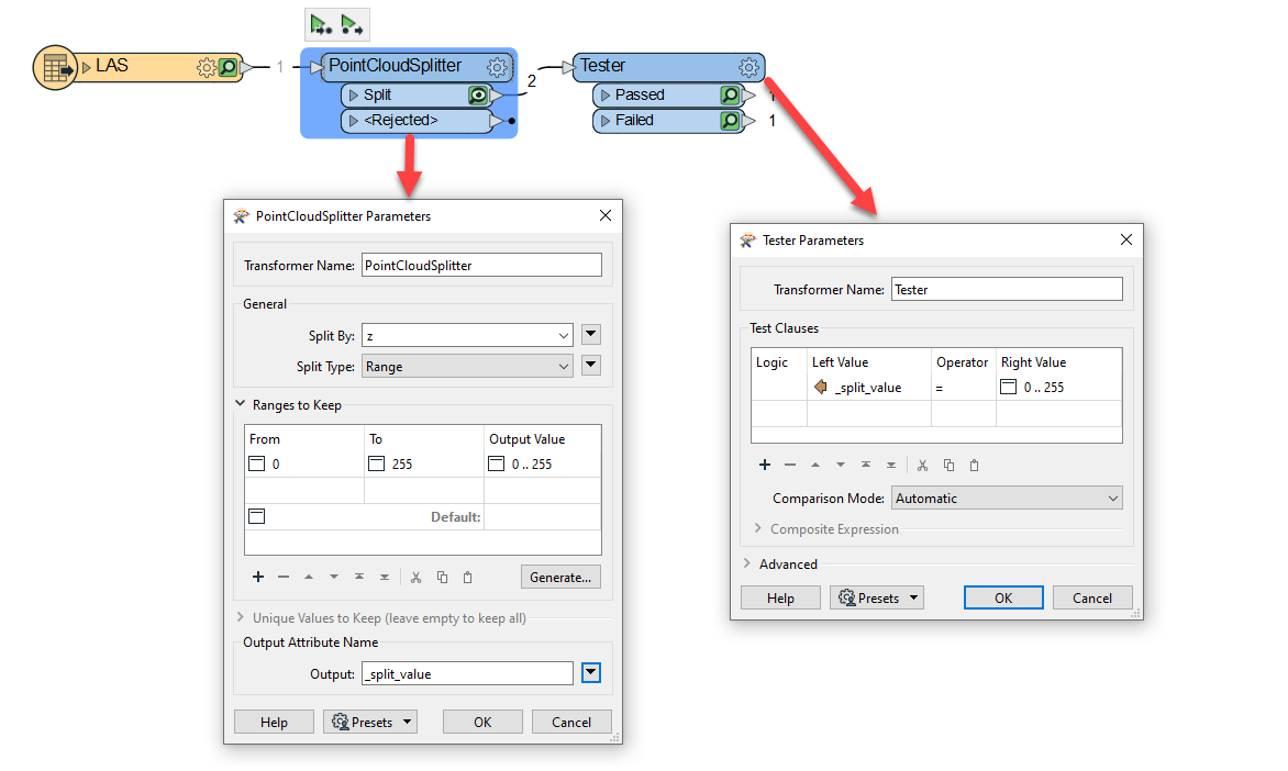
Reply
Rich Text Editor, editor1
Editor toolbars
Press ALT 0 for help
Helpful Members This Week


Enter your E-mail address. We'll send you an e-mail with instructions to reset your password.