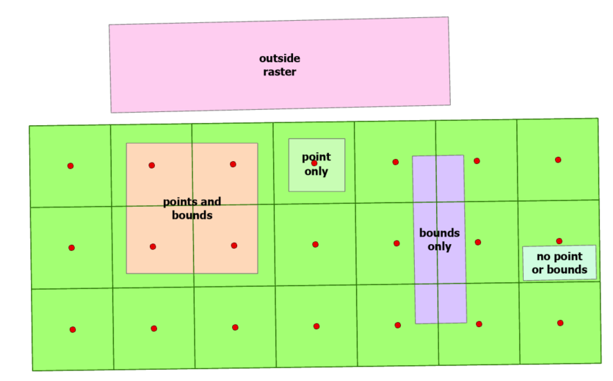
I was tasked with determing raster statistics (e.g. flood height and DEM elevations) for a large number of building footprints. I didn’t expect that the Clipper transformer would treat the following input Clipper polygons the same as outside Clipper polygons:
- With the “Determine Cell Location By: Centers” parameter, any clipper polygon that doesn’t intersect a raster cell center is treated as being outside, even though it intersects the raster. That is the polygons labelled below as “bounds only” and “no point or bounds” are treated as being outside the raster.
- With the “Determine Cell Location By: Bounds” parameter, any clipper polygon that doesn’t intersect a raster cell boundary is treated as being outside, even though it intersects the raster. In this situation the clipper polygon can have an area much greater than the raster cells. That is the polygons labelled below as “point only” and “no point or bounds” are treated as being outside.

Should Clippers that intersect a raster, but don’t result in a Clipping Transformer “Inside” output be sent to the “Rejected” output?


