
I have a DWG file with unknown CS but I know the CS it just needs to be assigned to the DWG. When I set the CS when I read the DWG then it appears in the correct location on the Earth but once I try to write it, it doesnt write the CS info and it appears again in the false location on Earth! I also tried “CoordinateSystemSetter” but with no success. On FME it appears good while transforming but not in the resulting DWG. Any Idea?

Solved
How write a DWG (Auto CAD) file with coordinate system?

") +1
+1- Contributor
Best answer by jovitaatsafe
Hi
By default, this parameter is unchecked so you’ll want to go into the Advanced settings and pick a storage method for ‘Coordinate System Storage’:
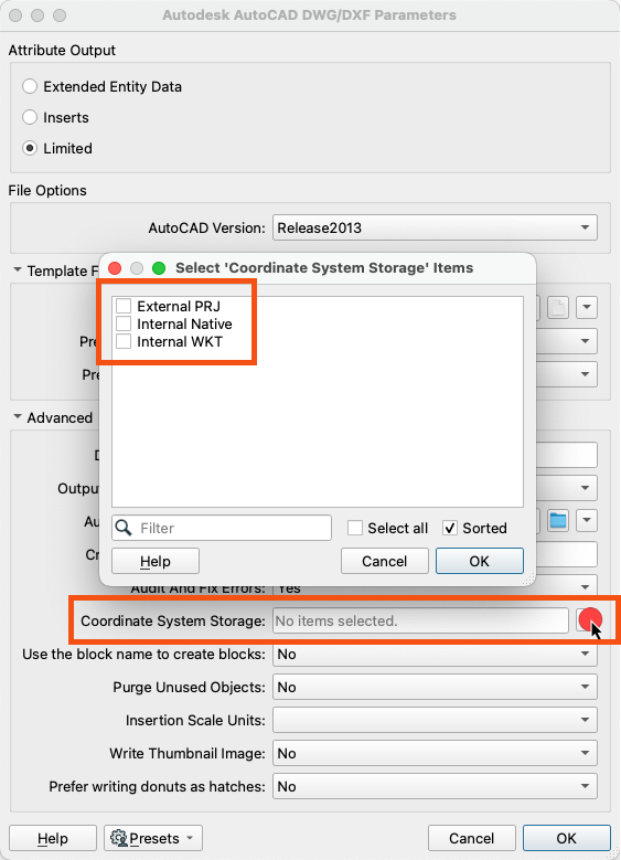
There are a few more details in our DWG Writer documentation here on what these options do.


")


Reply
Rich Text Editor, editor1
Editor toolbars
Press ALT 0 for help
Helpful Members This Week


Enter your E-mail address. We'll send you an e-mail with instructions to reset your password.