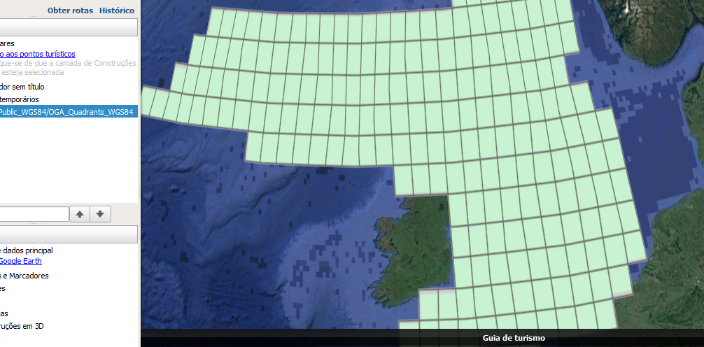
The URL for the reader is : https://itportal.decc.gov.uk/arcgis/services/OGA_Public_WGS84/OGA_Quadrants_WGS84/MapServer/WFSServer?request=GetCapabilities&service;=WFS

The XML for all the relevant URLs in the log file appear OK to me, and no errors are being reported (not even any warnings).

Hi @heidirk, can you confirm that geometry is being sent to the File Geodatabase?


Hi @TiaAtSafe, I only have a reader and a writer and the geometry is definitely not making it to the File Geodatabase and I don't think it's making it out of the reader. When I run with full inspection and look at the features between the reader and writer, they have no geometry. Is there another way to check?


Hi @TiaAtSafe, I only have a reader and a writer and the geometry is definitely not making it to the File Geodatabase and I don't think it's making it out of the reader. When I run with full inspection and look at the features between the reader and writer, they have no geometry. Is there another way to check?

Hi again @heidirk, when I read in the data from your WFS URL, I don't see any geometry being read in. Are you sure that there is geometry on the input?

@TiaAtSafe I did verify that there is geometry at the Rest endpoint of the service,

https://itportal.decc.gov.uk/arcgis/rest/services/OGA_Public_WGS84/OGA_Quadrants_WGS84/MapServer/.

I don't know how to confirm that the same is available in the WFS.


@TiaAtSafe I did verify that there is geometry at the Rest endpoint of the service,

https://itportal.decc.gov.uk/arcgis/rest/services/OGA_Public_WGS84/OGA_Quadrants_WGS84/MapServer/.

I don't know how to confirm that the same is available in the WFS.

Hi @heidirk,


And if you Read the KML link: KML with FME?


Thanks,


Danilo

Geometry is not being returned for WFS:

https://itportal.decc.gov.uk/arcgis/services/OGA_Public_WGS84/OGA_Quadrants_WGS84/MapServer/WFSServer?SERVICE=WFS&VERSION;=2.0.0&REQUEST;=GetFeature&TYPENAMES;=OGA_Public_WGS84_OGA_Quadrants_WGS84%3AQuadrants&NAMESPACES;=xmlns%28OGA_Public_WGS84_OGA_Quadrants_WGS84%2Chttps%3Aitportal.decc.gov.uk%2Farcgis%2Fservices%2FOGA_Public_WGS84%2FOGA_Quadrants_WGS84%2FMapServer%2FWFSServer%29&OUTPUTFORMAT;=GML3&COUNT;=30000

The envelope looks suspicious.

If the server is ArcGIS you can log a support call with Esri.

https://itportal.decc.gov.uk/arcgis/services/OGA_Public_WGS84/OGA_Quadrants_WGS84/MapServer/WFSServer?request=GetCapabilities&service;=WFS&version;=2.0.0


Reply