Hello,
I'm trying to get open LiDAR data from https://remotesensing.agiv.be/gis/geoserver/wms?REQUEST=GetCapabilities
As I only need an extent, a big one nonetheless (Xmin = 40050, Ymin = 202950, Xmax = 48385,3778, Ymax = 206209,4442, EPSG: 31370) I always get the same error on I guess the same area.
---------------------------
HTTP transfer error: 'Failure when receiving data from the peer'
XML Parser error: 'Error in input dataset:'https://remotesensing.agiv.be:443/gis/geoserver/wfs?SERVICE=WFS&VERSION=1.1.0&REQUEST=GetFeature&TYPENAME=Agiv%3ALiDAR_DHMV_II_LAZtiles&NAMESPACE=xmlns%28Agiv%3Dhttp%3A%2F%2Fmobile-mapping.agiv.be%29&BBOX=40050%2C202950%2C48385.3778%2C206209.4442%2Curn%3Ax-ogc%3Adef%3Acrs%3AEPSG%3A31370&OUTPUTFORMAT=application%2Fgml%2Bxml%3B%20version%3D3.2&MAXFEATURES=30000' line:1 column:415988 message:input ended before all started tags were ended; last tag started is 'gml:posList''
The XML Module halted on error, see the logfile for details
---------------------------------
I'm just taking my first steps in fetching data from WFS and WMS trough FME so I'm a bit lost to what the problem is here. Is this server sided or is my request wrong?
If more information is needed, just let me know.
Andreas


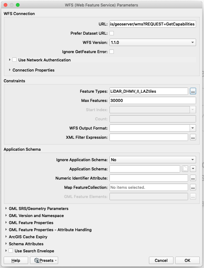
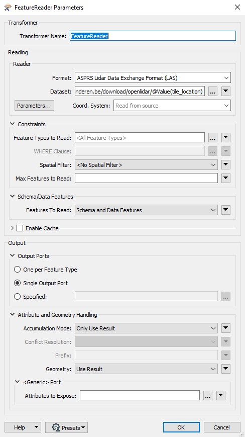
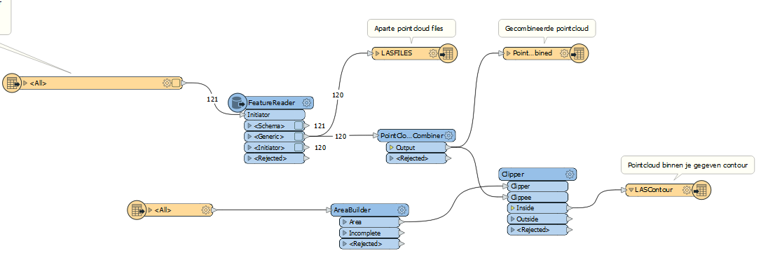
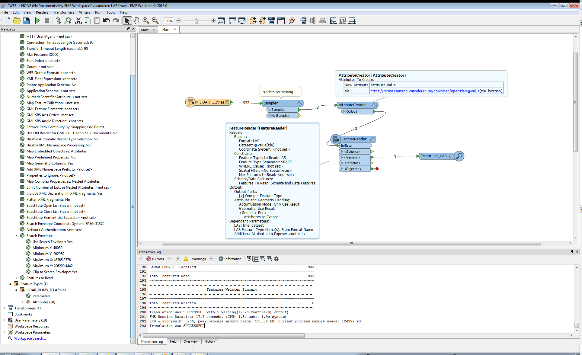
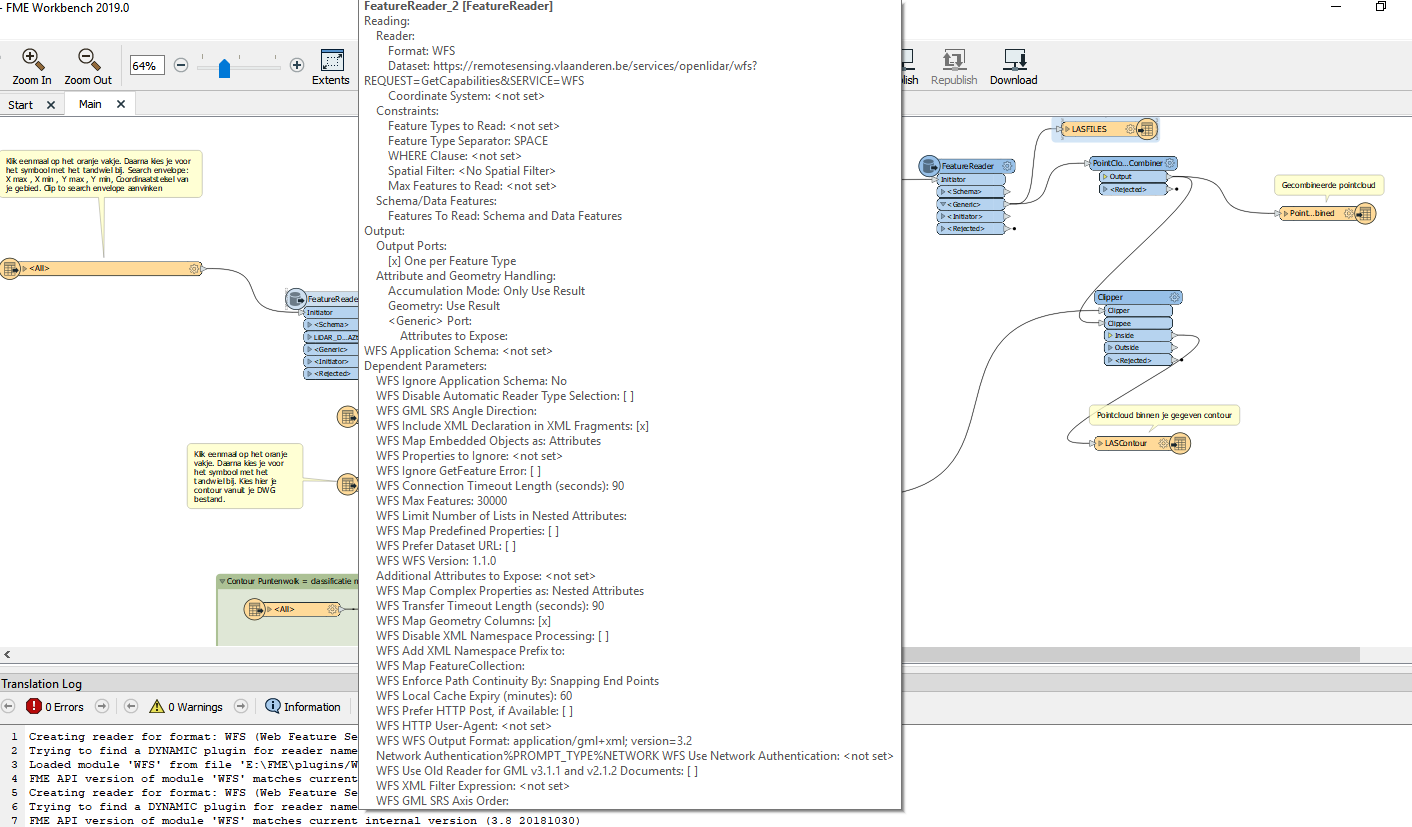
 This is also a screenshot of my featurereader to download all the LAS-files from the dataset.