Hi,
Please use a TINGnerator to create a mesh surface from the DTED. The TINSurface output is suitable for writing to Cesium 3D tiles.
Hi @daveatsafe,
Thanks for the suggestion.
Is there any example that i can reference to on the suggestion above?
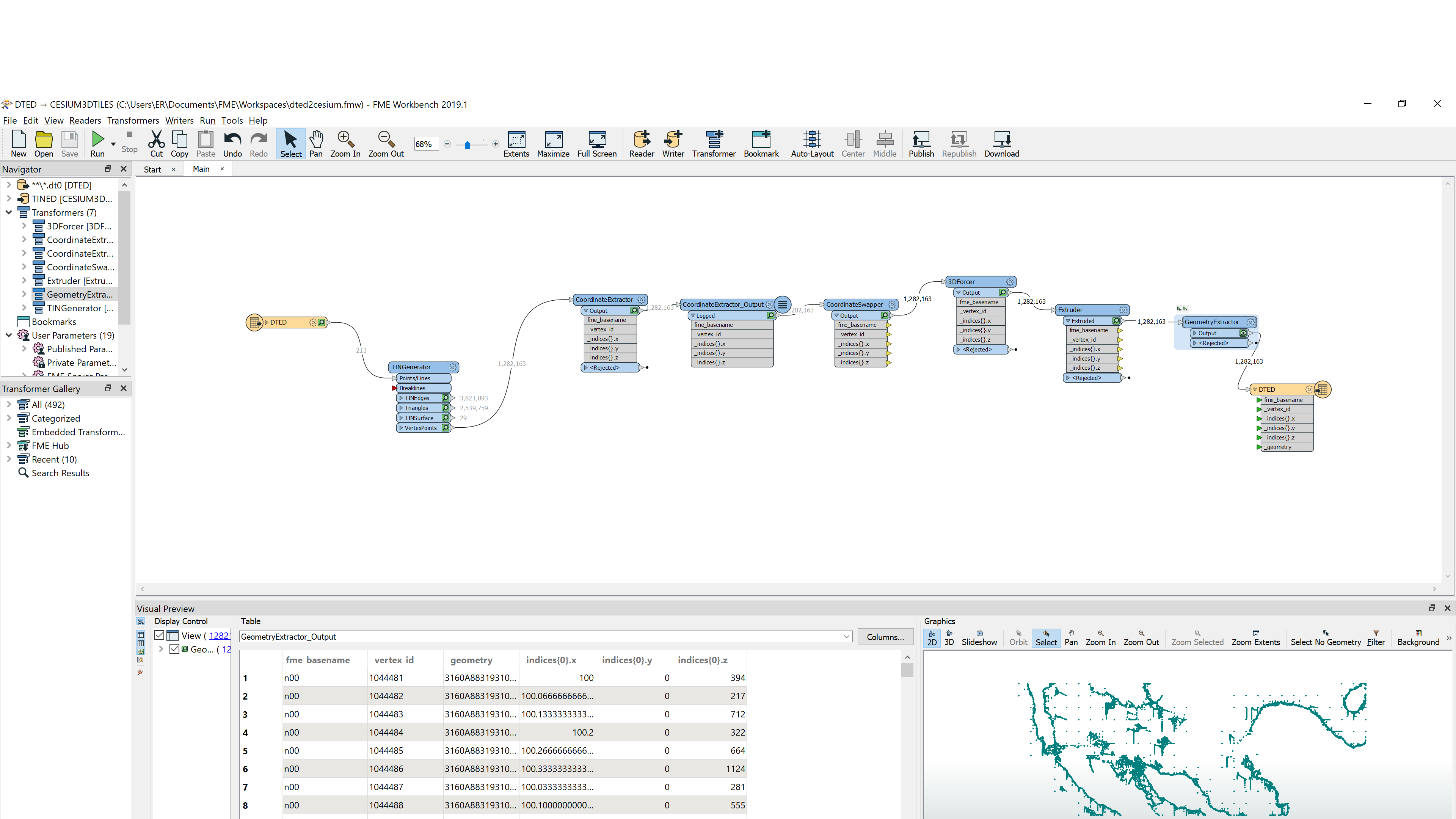
I tried something below, and managed to output a 3D Tile set but after loading it in cesiumJS, i could see it appeared anywhere. (i am pretty sure i loaded them correctly as i loaded other 3D tiles previously)
I did tried swapping the XY before creating the 3D tiles and extruded the Z but also no joy.
Or do u have a better way to represent DTED map data on cesium?
Try reprojecting to WGS84 before writing to 3DTiles
Please examine the feature properties of the TINSurfaces from the TINGenerator in the Visual Preview to ensure that they have coordinate systems. If not, you can use the CoordinateSystemSetter to set them to the coordinate system of your input DTED files. This is important, since the Cesium writer will reproject the data into the geocentric Cesium coordinate system. The TINSurface output will give you the appropriate geometry for Cesium output.
Hi Dave,
I tried applying the coordinate system setter for the TINGenerator (both before as input or after as output) and set coordinate system to LL84 as per the input DTED but i am not able to get extrude the geometry extracted from the TINSurface output. its always rejected. Thus, unable to produce any 3D tiles this time.
do you have any quick and simple workspace that I can reference on?
Thanks.
The TINSurface produced by the TINGenerator is a 3D mesh suitable for display in Cesium, but is not a simple surface that can be extruded. I should have asked earlier, but what would you like to see in Cesium? A surface representing the ground, or the individual points from the DTED?
my objective is to represent the terrain data from DTED Map source in the Cesium World.
Its like a mixture of having a surface of a plot of land with the terrain (elevation / height of each point) shown. Frankly i am not sure if this approach is correct via FME as my constant are DTED input and output on Cesium.
I was thinking to utilise the coordinates XY or YX with Z as the height / elevation data to create the required mesh for cesium.