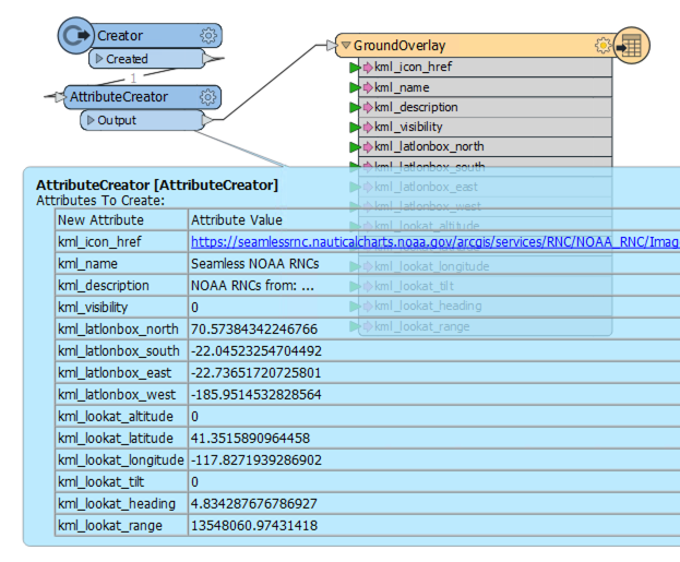
Trying to add WMS url in as a screen overlay/ ground overlay. I believe it has to be both, one to have it the navigation tree and one to display in GE. Here's the kml I'm trying to replicate:
<ScreenOverlay id="kml_8">
<Icon>
</Icon>
<overlayXY x="0" y="0" yunits="fraction" xunits="fraction"/>
<screenXY x="0" y="0" yunits="fraction" xunits="fraction"/>
</ScreenOverlay>
<GroundOverlay>
<name>Seamless NOAA RNCs</name>
<visibility>0</visibility>
<description>NOAA RNCs from:
http://seamlessrnc.nauticalcharts.noaa.gov/arcgis/rest/services/RNC/NOAA_RNC/ImageServer<br>
RNCs are updated by the 10th of each month.</description>
<LookAt>
<longitude>-117.8271939286902</longitude>
<latitude>41.3515890964458</latitude>
<altitude>0</altitude>
<heading>4.834287676786927</heading>
<tilt>0</tilt>
<range>13548060.97431418</range>
<gx:altitudeMode>relativeToSeaFloor</gx:altitudeMode>
</LookAt>
<Icon>
<viewRefreshMode>onStop</viewRefreshMode>
<viewRefreshTime>1</viewRefreshTime>
</Icon>
<LatLonBox>
<north>70.57384342246766</north>
<south>-22.04523254704492</south>
<east>-22.73651720725801</east>
<west>-185.9514532828564</west>
</LatLonBox>
</GroundOverlay>


