I have a set of tabluar data with attributes (X, Y, EPSG). Where the ESPG can be any valid coordinate system. My goal is to create a set of points in a common coordinate system.
I understand I could use a TestFilter for each EPSG I'm expecting then create points, but the workbench will fail if the data contains an EPSG code I didn't expect.
What is the best approach to create points in a single coordinate system without hard-coding the workbench for a set of expected coordinate systems?
Thanks
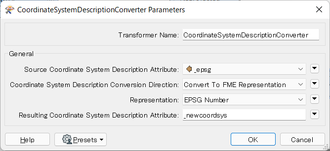 You can then set the resulting attribute (called "_newcoordsys" by default) to the Source Coordinate System parameter in subsequent CsmapReprojector.
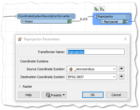

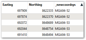 Then I used that in Reprojector to write out points in a single CRS