Question

Overlapping polygons and latest date filter.

  • November 10, 2017
  • 1 reply
  • 34 views

I have a dataset of state pesticide permit polygons. Each polygon is identified by a permit number and site id plus there are attributes for effective date and expiration date. In many cases the polygons overlap in one of three ways:

  • 1. Edge overlaps where imprecise drawing causes overlaps.
  • 2. Polygons are designed to represent the same area. Sometimes these are drawn slightly differently so they are not exact matches

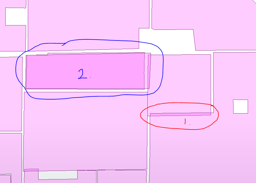
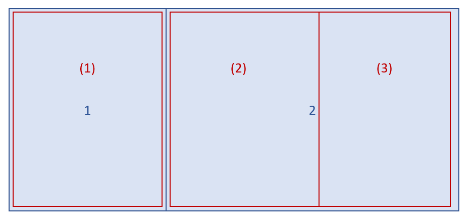
  • 3. The same area is divided into different numbers of polygons at different times.

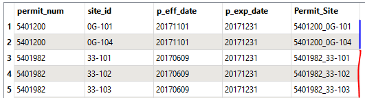
What I need to do is take overlap cases 2 & 3 and keep the overlapping polygon with the most recent effective date.

This post is closed to further activity.
It may be an old question, an answered question, an implemented idea, or a notification-only post.
Please check post dates before relying on any information in a question or answer.
For follow-up or related questions, please post a new question or idea.
If there is a genuine update to be made, please contact us and request that the post is reopened.

1 reply

redgeographics
Celebrity
Forum|alt.badge.img+60
  • Celebrity
  • 3704 replies
  • November 11, 2017

The AreaOnAreaOverlayer can do the overlaying for you, if you set it to generate a list and then use a ListSorter to sort that list on the effective date you can use a ListIndexer to grab the attributes of the most recent element as the attributes of the resulting feature.

If you're concerned about the slightly different boundaries you could try using a Snapper before the overlaying to try and clean it up a little bit.