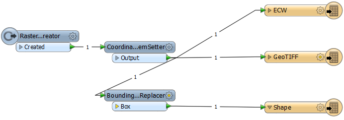
I have a raster in coordinate system EPSG:25833 (ETRS89.UTM-33N). The coordinate system is saved with name ETRS_1989_UTM_Zone_33N in GeoTIFF and Esri Shapefile, but in ECW with name NUTM33. The coordinate systems are the same, only with different name.

I have viewed the properties with Esri ArcGIS. The different coordinate system names are in ArcGIS no porblem, but in the software GeODin Maps.
How to do it to write coordinate system name ETRS_1989_UTM_Zone_33N into the ECW file?


