Question

How to clip polygon overlap


hoa_le
Contributor
Forum|alt.badge.img+5
Hi,


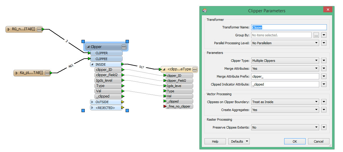
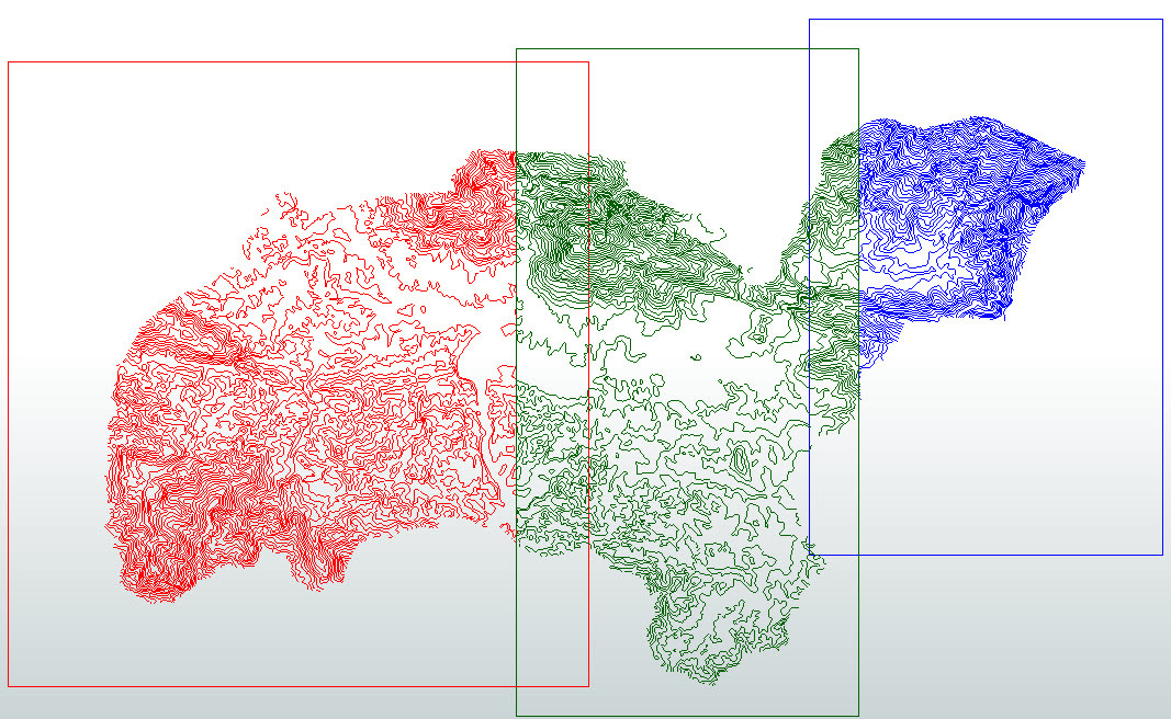
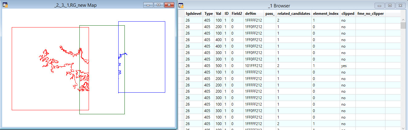
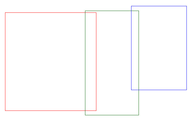
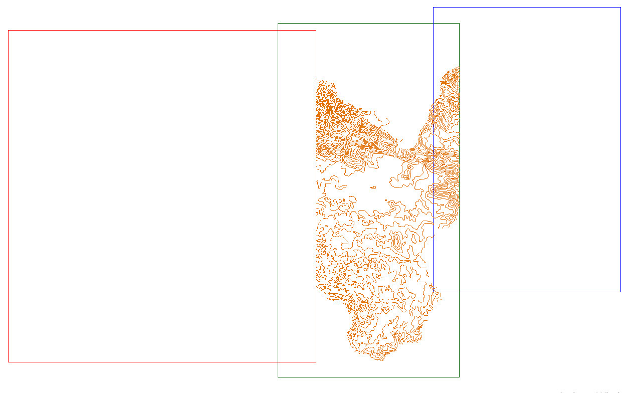
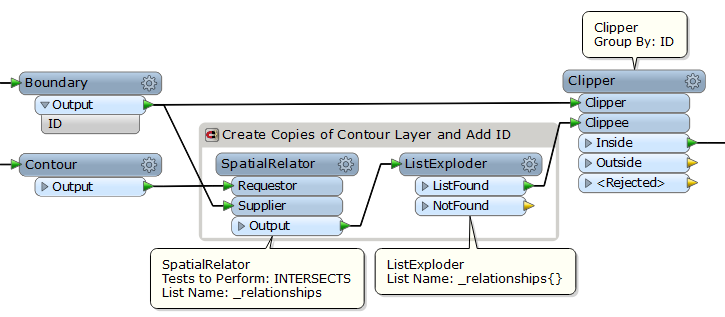
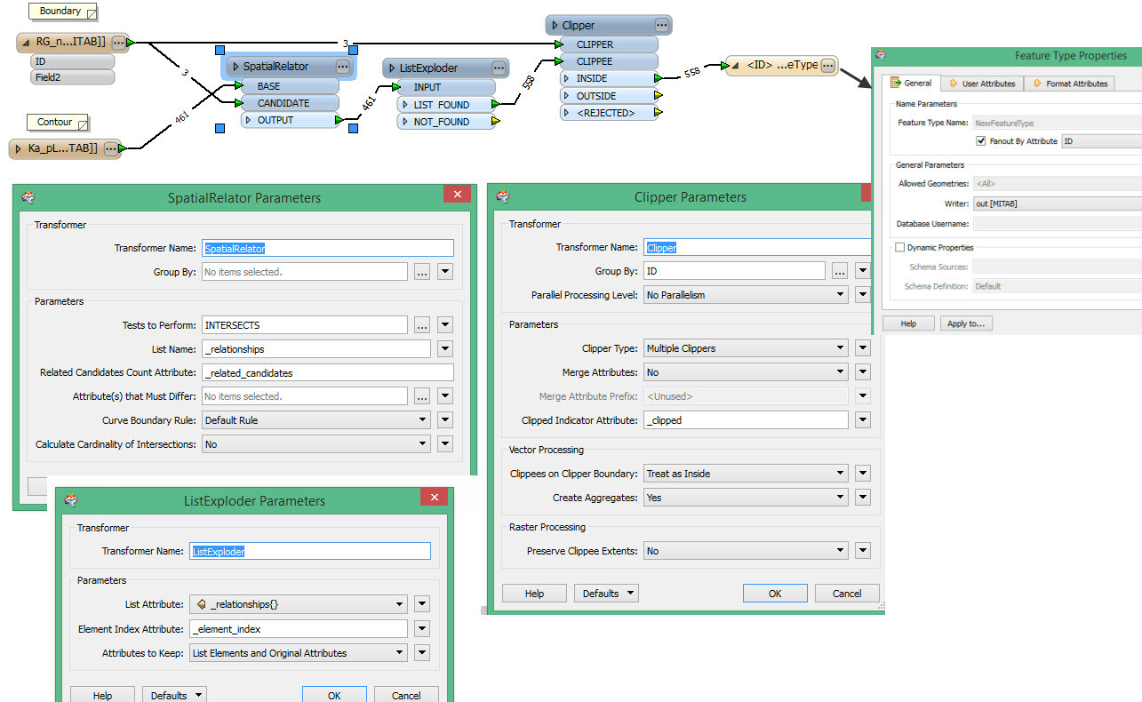
I have a contour layer and a boundary BUT the boundary is overlay. It means the boundary has 3 zone:


Now, I want to clip contour layer based on boundary. I used to clip but it wasn't as I want.


Could you tell me please how can I do?

12 replies

takashi
Contributor
Forum|alt.badge.img+19
  • Contributor
  • August 13, 2014
Hi,


If you need to create 3 contour layers each of which is inside of corresponding boundary, create 3 copies of the contour layer; add boundary ID to them; clip them by the boundaries using the Clipper (Group By: ID).


Takashi

hoa_le
Contributor
Forum|alt.badge.img+5
  • Author
  • Contributor
  • August 13, 2014
Hi,


But if I have multiple boundary, how can I do? Could you tell me how I do?


takashi
Contributor
Forum|alt.badge.img+19
  • Contributor
  • August 13, 2014
If I understood your question correctly, this workflow works.


hoa_le
Contributor
Forum|alt.badge.img+5
  • Author
  • Contributor
  • August 13, 2014
Hi,


I tried it and and my result isnot  still true:


My model :


Could you tell me why? Thank you

takashi
Contributor
Forum|alt.badge.img+19
  • Contributor
  • August 13, 2014
I cannot find any wrong part in the workspace. If you hide green contour lines on the viewer, how do others appear?

gio
Contributor
Forum|alt.badge.img+15
  • Contributor
  • August 13, 2014
..yes, turn of the green one...


You should have overlapping clipped objects using the described process.


This is because of the duplication of overlapped objects trough listexplosion and subsequent Grouping.

hoa_le
Contributor
Forum|alt.badge.img+5
  • Author
  • Contributor
  • August 13, 2014
Hi,


The above photo I open by connect Inspector in FME. It's OK


BUT when I write in mapinfo, I got result :


Could you tell me please why?? Thank you

takashi
Contributor
Forum|alt.badge.img+19
  • Contributor
  • August 13, 2014
Try to open and check the MapInfo data using FME Data Inspector.

hoa_le
Contributor
Forum|alt.badge.img+5
  • Author
  • Contributor
  • August 13, 2014
I tried to write in Mapinfo. I saw in brown table, they have many record BUT in my map, it's some line :(.

takashi
Contributor
Forum|alt.badge.img+19
  • Contributor
  • August 13, 2014
Therefore, I've recommended you to check the MapInfo data with FME Data Inspector. You can open the data with Data Inspector directly. And also, I would recommend you to see the Log after the translation. If there were any problem while writing the MapInfo data, some warning messages might be logged.

hoa_le
Contributor
Forum|alt.badge.img+5
  • Author
  • Contributor
  • August 13, 2014
Hi,


It's my log file. 


https://www.mediafire.com/?i6omoi489lmzbli


Could you help me and please let me know that I met problem?


Thank you


takashi
Contributor
Forum|alt.badge.img+19
  • Contributor
  • August 13, 2014
Looks like there is an inconsistency between "mapinfo_type" attribute value and the actual geometry type. Try removing "mapinfo_type" from every feature before writing. You can expose "mapinfo_type" with the AttributeExposer before removing.

Reply


Cookie policy

We use cookies to enhance and personalize your experience. If you accept you agree to our full cookie policy. Learn more about our cookies.

 
Cookie settings