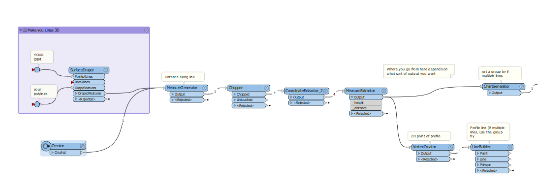
I was looking at ways to create Elevation profiles but did not find any transformers or other easy ways to do this in FME. Should I be searching for some other word?
I don't need anything fancy, the sources are some polylines and a DEM file. I would be happy with something as simple as a csv file as output.