Hi! I have a gml file that i have downloaded from the statistical bureau of sweden. This is the data source: https://share.scb.se/OV0105/Xml/PD/pd_befolkningsfordelning_totalbefolkning_nt.xml


It is in GML format and the data is structured in 10km squares. However, I can't seem to be able to convert it to any other format. The geometry im getting is just a bounding box for the entire dataset, not the specific 10km squares. I have found very limited resources to help with this problem online. The final destination should be in an enterprise geodatabase.


Has anyone else had trouble with this? Thankful for any help.


/Alex

This is just metadata on how to access the data - it looks like an Atom feed: Atom (web standard) - Wikipedia


inside the xml file there is another URL: share.scb.se/OV0105/Xml/PD/pd_befolkningsfordelning_totalbefolkning_nt.xml


And in here are urls to download the zip date.


this tutorial might be helpful to access data via an atom feed:

Read INSPIRE ATOM Download Services with FME (safe.com)

Oops, I posted the wrong link, sorry. The one you posted is the correct one. The dataset I'm working with is this: https://share.scb.se/OV0105/Data/PD/Totalbefolkning/PD.Befolkningsfordelning.Totalbefolkning.lan01.zip


I can't seem to be able to access the geometry of the individual squares, all it returns is a bounding box.


Oops, I posted the wrong link, sorry. The one you posted is the correct one. The dataset I'm working with is this: https://share.scb.se/OV0105/Data/PD/Totalbefolkning/PD.Befolkningsfordelning.Totalbefolkning.lan01.zip 


I can't seem to be able to access the geometry of the individual squares, all it returns is a bounding box.

Yeah so the geometry for each of these feature is all the same - it is the bounding box - I'm not sure if this is an issue with the data or not.


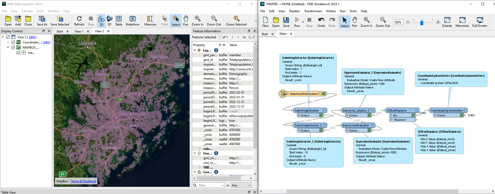
But you can also use the gml_id to build the geometry:

Totalpopulation_lan01_SE_CRS3035RES1000mN4037000E4742000

 - it includes the tile size (1000m), the CRS (3035), the Northing (4037000) and the Easting 4742000. 


imageThere's probably a proper way to work with the data, but I guess this method also works 😏 


Reply