Ok, figured this out. Being back in an Australian office on Monday morning, I think everyone else in the world is spending their Sunday.
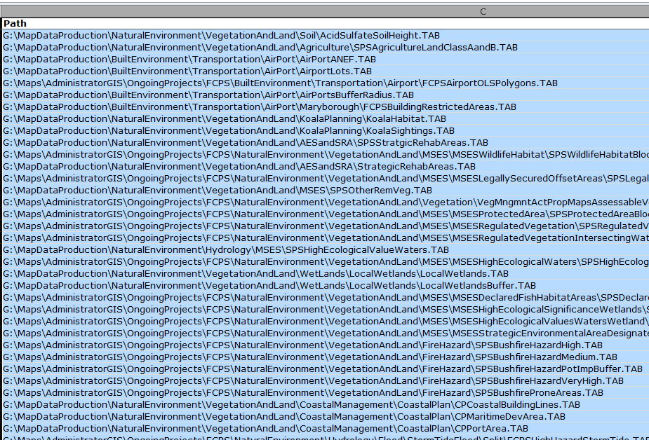
I concatenated the filepaths separated by comma (using Notepad++ program) to make it appear as follows
filepath1, filepath2, filepath3, filepath4
copied this string into Source files box.
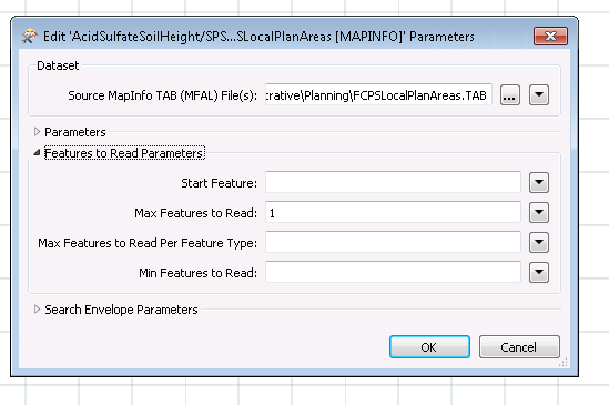
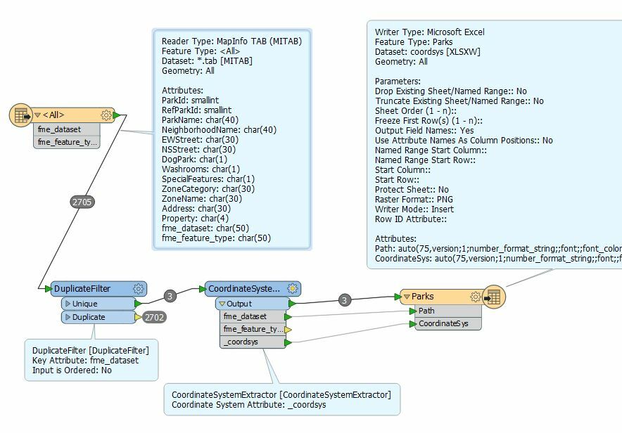
I wanted to just read one feature per file and that is enough for me to read the projection information.
Used CoordinateSystemExtractor to extract the _coordsys attribiute.
Written the FileName, Path and _coordsys attributes back to Excel.
Job done.
I wish I could devote more time learning FME's powerful features to make my life easier.
Thanks,
Thiru