I have an urgent question regarding the transformer "NeighborhoodAggregator".
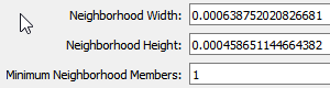
The following numbers are used for the width and height which are equivalent to 0.0316897 (mile).
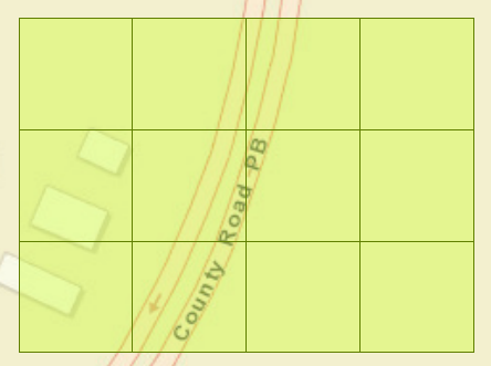
I also used 2D Gridder to visualize the width and height and it looks like the following image.
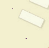
My question is that how come my 2 points which are 0.0316897 (mile) apart, do not get aggregated. I am using EPSG:4326 for my coordinate system. By the way, what is the difference between doing buffer/dissolve compared to using NeighborhoodAggregator?
Best answer by ebygomm
The neighbourhood aggregator doesn't work in the way you are expecting it to (or the way that would be most useful!). It effectively creates a grid of squares which are the size of the neighbourhoods and then groups features depending on which square their centre point falls within.
I expect a process where you buffer and dissolve to define your neighbourhoods will give an output closer to what you are looking for.
You can also use a neighbourfinder followed by a list combiner to create a common attribute for all features within a certain distance of each other
We use 3 different kinds of cookies. You can choose which cookies you want to accept. We need basic cookies to make this site work, therefore these are the minimum you can select. Learn more about our cookies.