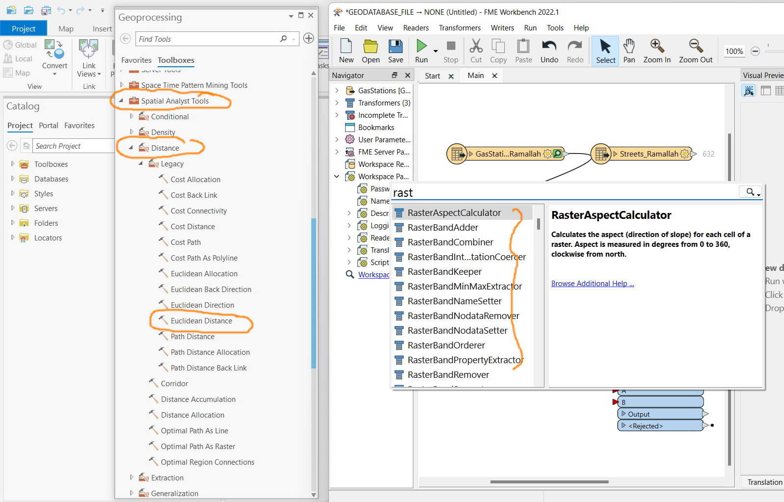
FME Desktop 2022.1: What is the equivalent tool of “Euclidean distance” of ArcGIS Pro in FME?


I couldn’t figure of if all Raster tools that are available in ArcGIS Pro have equivalent tools\\transformers in FME


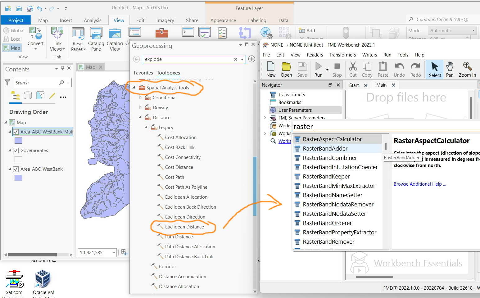
For example, what is the equivalent tool of “Euclidean distance” of ArcGIS Pro in FME?


Clip_930

Hi Jamal,

Depends what you're trying to do... what are you wanting to calculate distance between? Raster grid cells? Points? Points to lines?


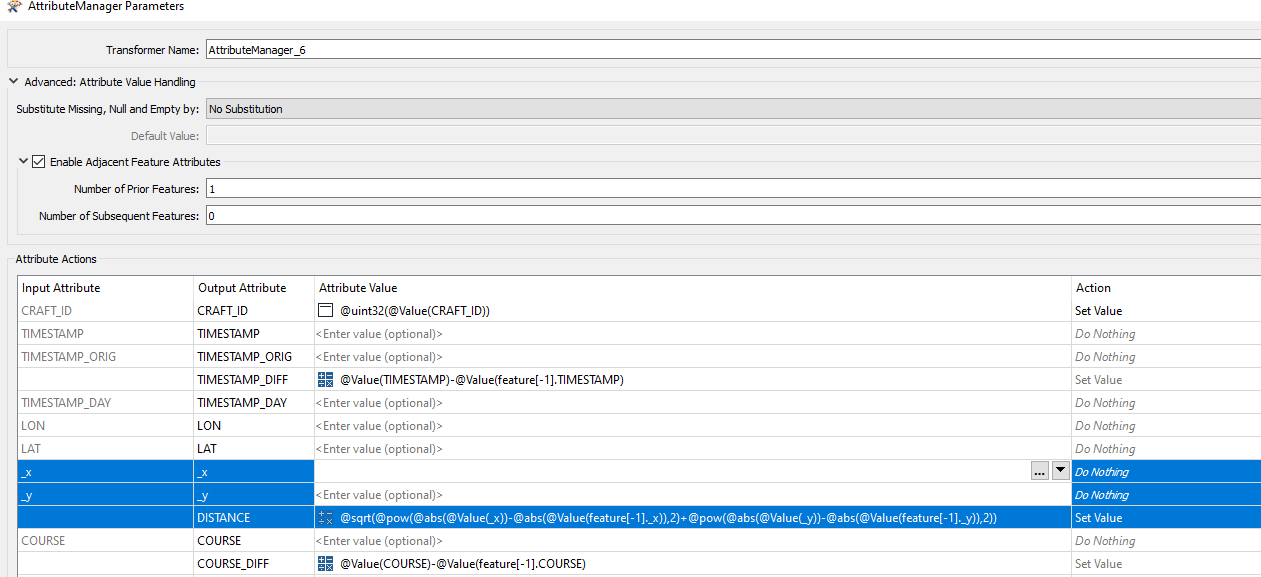
In the past I've wanted to calculate distance between two points. I reprojected to a metric system, used coordinate extractor to get the X Y, then in an attribute manager turn on the 'enable adjacent feature attributes' and set number of prior feature = 1. Then in the attribute value you calculate distance between X and Y

Distance calc in attribute manager using extracted coords@sqrt(@pow(@abs(@Value(_x))-@abs(@Value(featuree-1]._x)),2)+@pow(@abs(@Value(_y))-@abs(@Value(featuree-1]._y)),2))


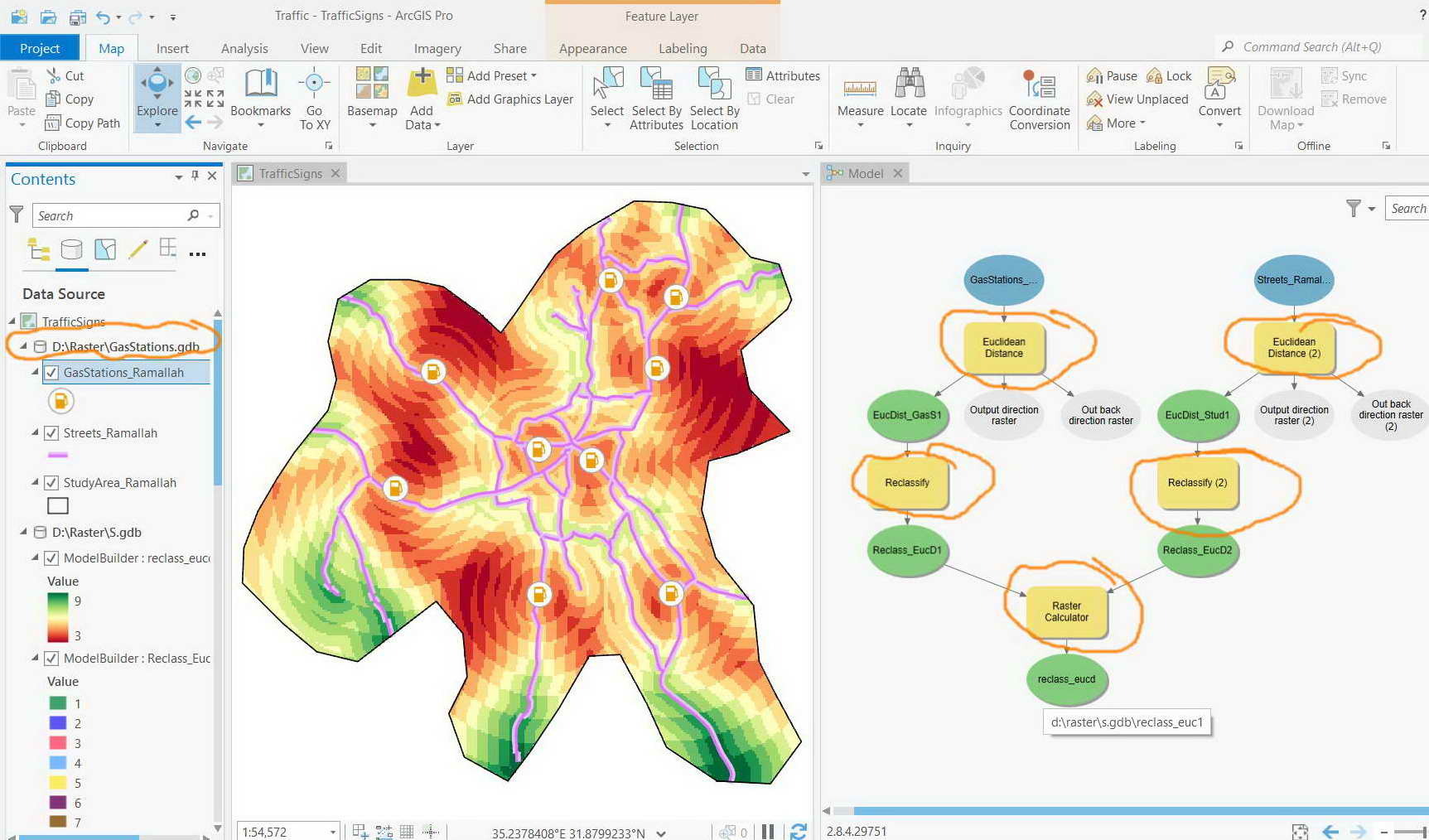
In the example below (also attached), the “Euclidean distance”, “reclassify”, and “raster calculator” tools of ArcGIS Pro are performed in order to identify the best location for the establishment of a new gas station that meets the following:


1)    To be as far as possible from the existing gas stations

2)    To be as close as possible from the roads


What cloud be equivalent transformers in FME for “Euclidean distance”, “reclassify”, and “raster calculator” tools?


Clip_950

A bufferer transformer creates a buffer zone of specified size around or inside input geometry.

RasterPropertyExtractor extracts the geometry properties of a raster feature and exposes them as attributes. After this transformer you probably what to use a combination of Testers and Attribute Managers to change attribute values under certain conditions

RasterCellValueCalculator evaluates basic arithmetic , minimum, maximum or average operations on the cell values of a pair of rasters.


Appears that the FME has no sufficient tools when it comes to raster analysis. Am I correct?


Clip_963 


A bufferer transformer creates a buffer zone of specified size around or inside input geometry.

RasterPropertyExtractor extracts the geometry properties of a raster feature and exposes them as attributes. After this transformer you probably what to use a combination of Testers and Attribute Managers to change attribute values under certain conditions

RasterCellValueCalculator evaluates basic arithmetic , minimum, maximum or average operations on the cell values of a pair of rasters.

Hi @jamesb16otterill​ 

Can you elaborate on your proposed approach? I do not see how the transformers you listed address jamal's use case. Basically we want to mimic the Euclidian Distance tool of ArcGIS Spatial Analyst. Thanks!

I think GDAL has a similar tool called the Proximity tool and it can be run in QGIS or called from within FME using a SystemCaller.


Reply