Hello,
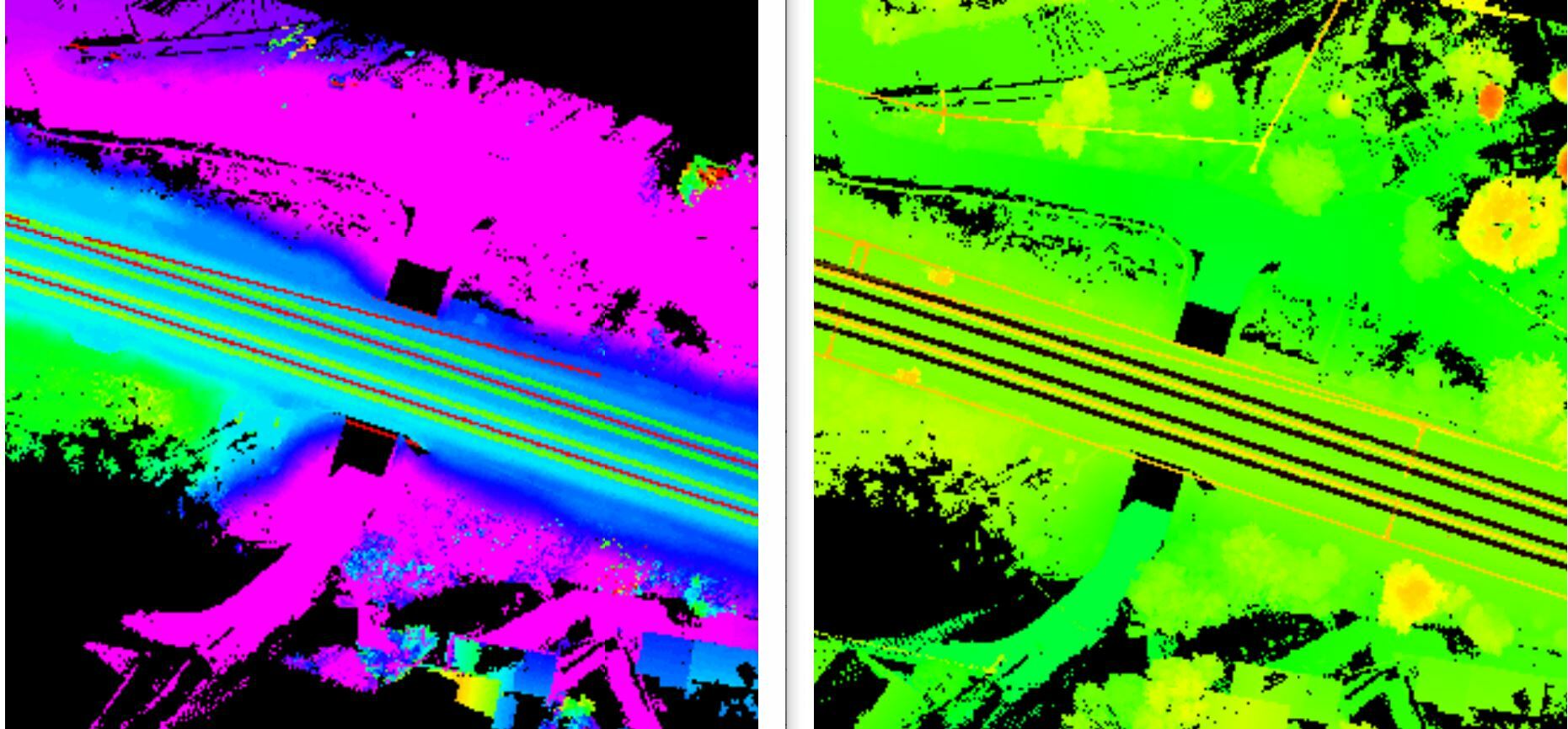
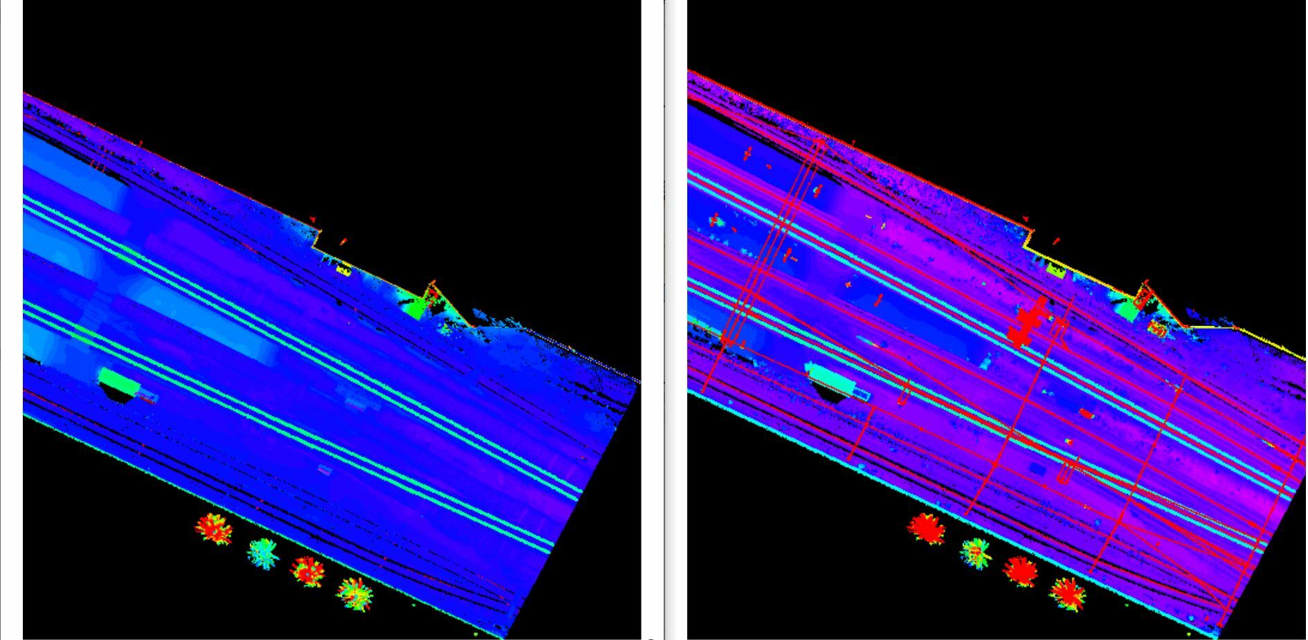
I've made a FME to raterize some point cloud into elevation raster but I'm not satisfied with the result. I would like to be able to specify in the transform parameters which point is used to color the raster (min z, max z, etc ...). Indeed when we have power lines for example it is desirable that the point used for coloring is that of the line and not that of the ground. This makes it possible to highlight it in the Raster.
Do you know if there is a way to control the coloring in this way?
Example :
That is what FME give me (left) and what I want (right)

You'll see the difference on wire and tree
Regard,
Arnaud


