Hi @v.martin_96
have you tried to turn point cloud and roof shapes into separate surface rasters, and subtract them to see the difference figures? Both data sets can be turned into rasters by help of SurfaceModeller.
You could try to use a PointCloudCoercer to create individual points, (I created an arbitrary surface with a bounding box and gave it a Z), extract the coordinates, overlay, and then use an ExpressionEvaluator to get the difference. After that is complete, you can turn it back into a point cloud with a combiner.
Attached .fmw
I ran through 10 million points in 5 minutes, but my laptop is pretty old so it should be fairly quick on beefier machine. 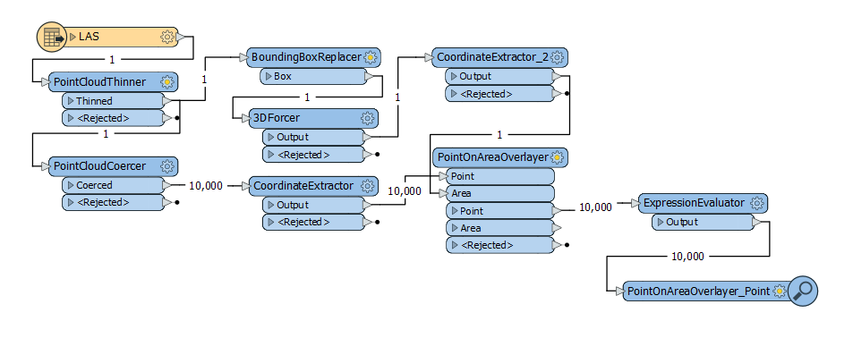
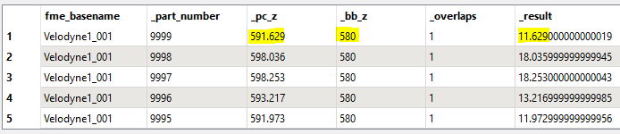
You could try to use a PointCloudCoercer to create individual points, (I created an arbitrary surface with a bounding box and gave it a Z), extract the coordinates, overlay, and then use an ExpressionEvaluator to get the difference. After that is complete, you can turn it back into a point cloud with a combiner.
Attached .fmw
I ran through 10 million points in 5 minutes, but my laptop is pretty old so it should be fairly quick on beefier machine.
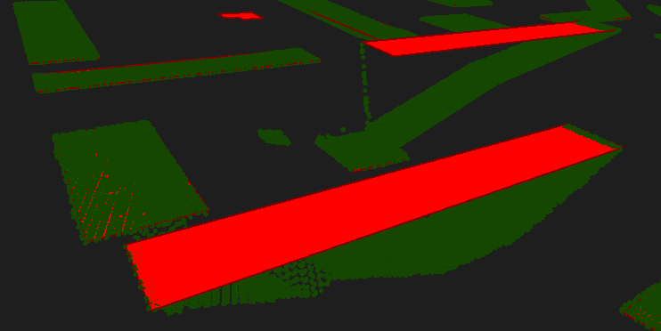
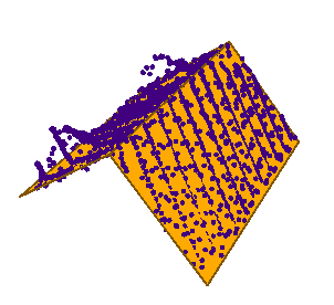
Thank you for your comment ! Indeed, it works for flat roofs. But I'd like to create a script that can do it for roofs that don't have the same Z value on their whole surface like the picture below.
Thank you in advance !
Thank you for your comment ! Indeed, it works for flat roofs. But I'd like to create a script that can do it for roofs that don't have the same Z value on their whole surface like the picture below.
Thank you in advance !
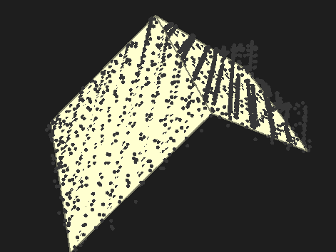
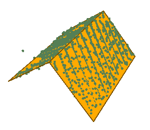
Adding a chopper to the 3D roof with a .1 unit chop produces a grid to overlay the points on to inherit the z values. I'm assuming you are looking to filter out the data that isn't near the roof. See example shots below with the error removed. There is one point that for some reason or another decided it wanted to be a part of the roof.
Attached .fmwt with all data included.
(deleting comment below requesting data)
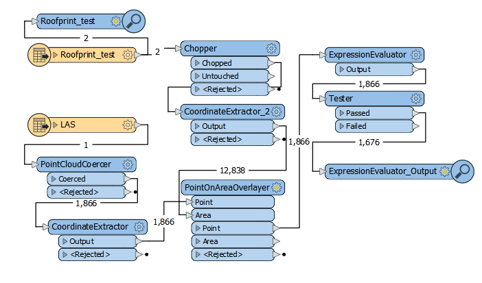
Representation as is
Representation chopped and filtered
Adding a chopper to the 3D roof with a .1 unit chop produces a grid to overlay the points on to inherit the z values. I'm assuming you are looking to filter out the data that isn't near the roof. See example shots below with the error removed. There is one point that for some reason or another decided it wanted to be a part of the roof.
Attached .fmwt with all data included.
(deleting comment below requesting data)
Representation as is
Representation chopped and filtered
It work ! Thank you very much for your help !
It work ! Thank you very much for your help !
Awesome! Most welcome! Please mark the question as answered.