Hi all!

I want to transform a .laz file (attached) to raster, specifically the buildings and soil entities so prior to the RasterDEMGenerator I use the point cloud splitter and the attribute filter to get the ones that have 6 and 2 values.
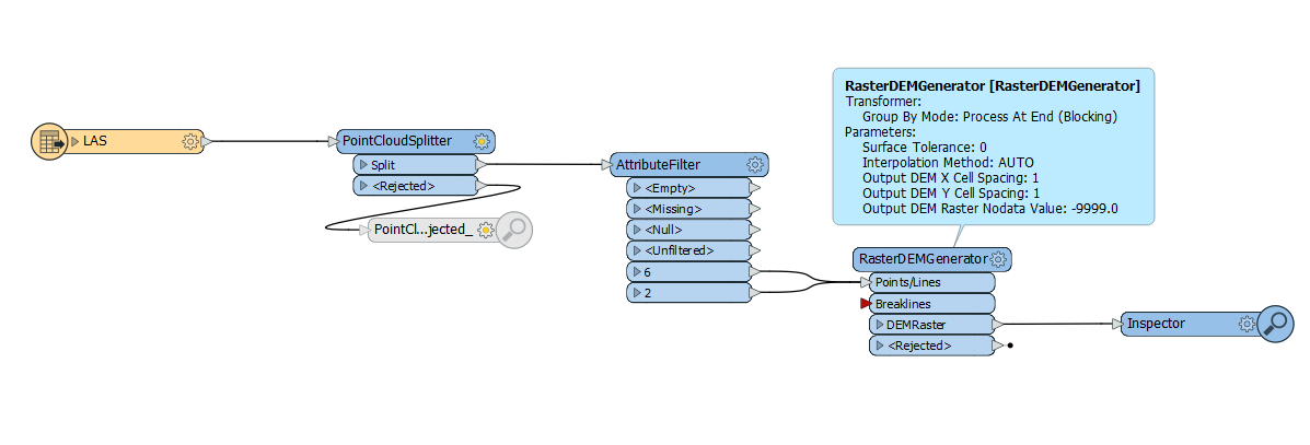
flow


The problem is that the output raster has a one-cell-wide frame with incorrect values all around.
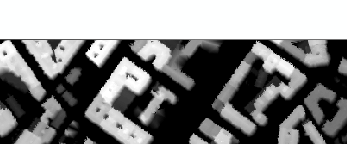
del


red


Zoom:

zoom


Regarding RasterDEMGenerator, I have tried different values in both cell spacing and surface tolerance parameters, as well as all three interpolation methods and the frame stills there.

Just removing the frame with the RasterSubsetter is not an option as eventually I will have to merge it with adjacent others and would leave a space without data where they should be touching.


UPDATE:

I've found this thread where the user dmitribagh confirms that the wrong bounding pixels are an intentional behaviour of the transformer:

https://safesoftware.cloud.answerhub.com/questions/106377/raster-dem-from-pointcloud-raster-origin.html


Probably a silly question, but are you sure you're not looking at both rasters (building and soil) over the top of each other. And the frame is just from the Soil points? ​


Probably a silly question, but are you sure you're not looking at both rasters (building and soil) over the top of each other. And the frame is just from the Soil points? ​

Not silly at all, I though the same at the beginning but the RasterDEMGenerator outputs a single raster so there is only one to look at.

Also the frame stills there even if I only transform the 6 or the 2 entities alone


Opening post updated with new info!


Opening post updated with new info!

An nice find - Here he means by using an Offsetter transformer.


An nice find - Here he means by using an Offsetter transformer.

I misunderstood the transformer, thought the Offsetter would make something similar to the padder but it only moves around the point cloud. Sadly not a choice


An nice find - Here he means by using an Offsetter transformer.

Hey @fmeisgroovy​ any further luck with this issue?


An nice find - Here he means by using an Offsetter transformer.

Not sure if this will do anything, but you coooulld try and use a NumericRasteriser first to get a raster (it will probably have holes) but then use a RasterDEMGenerator. I assume the result will be the same but it might be a work around​


An nice find - Here he means by using an Offsetter transformer.

Hi @daraghatsafe​. If you read the thread of the link at the bottom of my opening post, no luck for now and there probably won't be any. It seems this is the way the transformer works. 

@virtualcitymatt​ It was a REALLY good try. No holes at all, the bounding dissapeared in three sides except for the top one, and in several fragments of this one. But some other fragments remain, along with the fact that definition is noticeably worse. However thanks a lot for the idea, it was almost there and I might be able to use it in further projects.


Reply