
Hi,


I am very new to FME so please bear with me while I try and explain what I am after.


I have 215 projects that are pinned to an individual lat long. I have multiple geospatial data sources that contain various polygons of areas. I am using spatial filters to see if a project has intersected passed or failed in that filter.


For the 215 Projects, I would like to create an KML with a token radius, say 500m that shows all of the other polygons around that project for that distance. If I combine all of the polygons into one KML centred on the project, the file is massive.


I just want a KML reduced to the polygons that are within 500m of the project centred on the project.

It sounds like you have the right idea with the SpatialFilter. Just to confirm, you are starting with a point or interest correct? If so, the next thing you'd need to do is create a 500m buffer around the point in order to filter for polygons in your area of interest. As long as ALL features are using the same coordinate system, the SpatialFilter will be able to tell you which features are within/intersect/etc. the area of interest and the Passed features can then be sent to a KML Writer.

2021-05-28_8-46-33
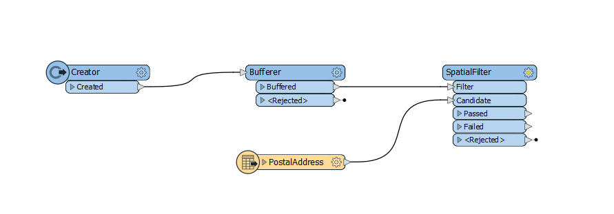
If you wanted to cut down on file size, there are two options, simplify the geometry by reducing the number of vertices or write the output to .kmz by specifying the .kmz extension in the destination dataset parameter when adding the writer.


Hi! Thanks for your answer.

Yes, single point of interest is the starting point and comparing against many databases with many entries.


In the end, I ended up using a Neighborfinder. I picked up everything within X distance and then grouped them in to the KML based on the task ID.


It has worked quite well.


Thanks very much for your help!


Reply