


Hello All
I am currently modifying a workbench to chop pavement polygons based on the street id and then dissolve them back together, again based on the street id.
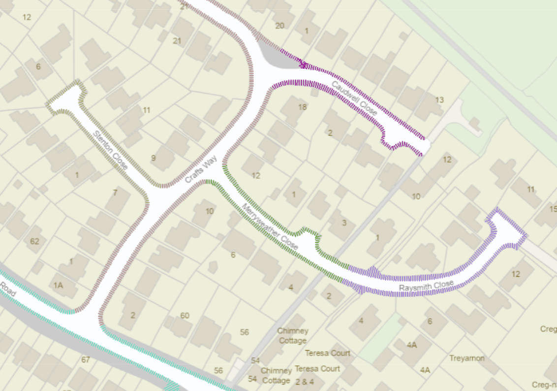
I have used a neighbour finder to get the nearest street and merged those attribute together with the chopped pavement line. This all looks good as can be seen below, where each road (from a feature color setter) for visualisation is correct.
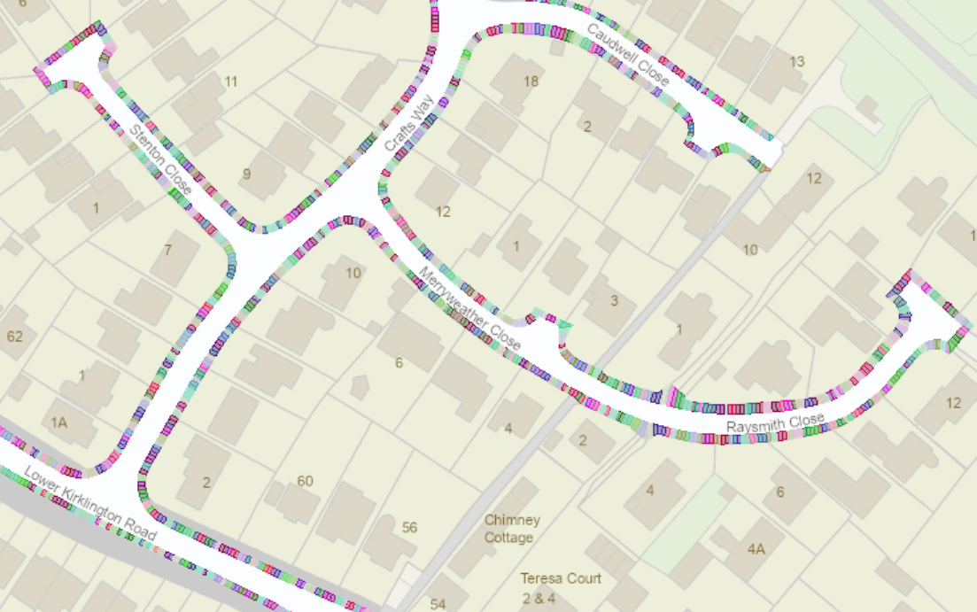
However, when i try and put these lines through the line on area overlayer to chop the pavement polygons up, different street id’s are being added to each polygon, hence i can not then disolve them back again.
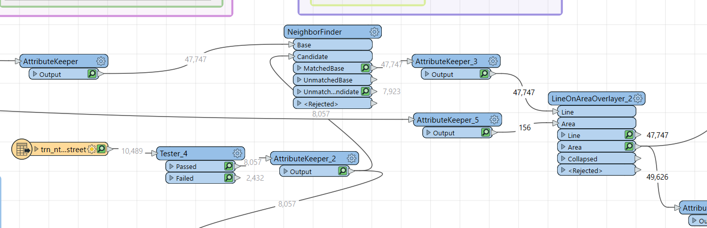
PArt of the workbench below - not tidied up yet ..sorry
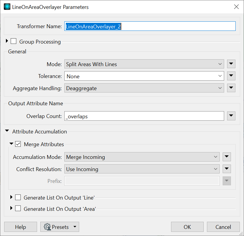
Parameter setting for line on area overlayer below
Any help on what is wrong would be appreciated.
Thanks in advance.


