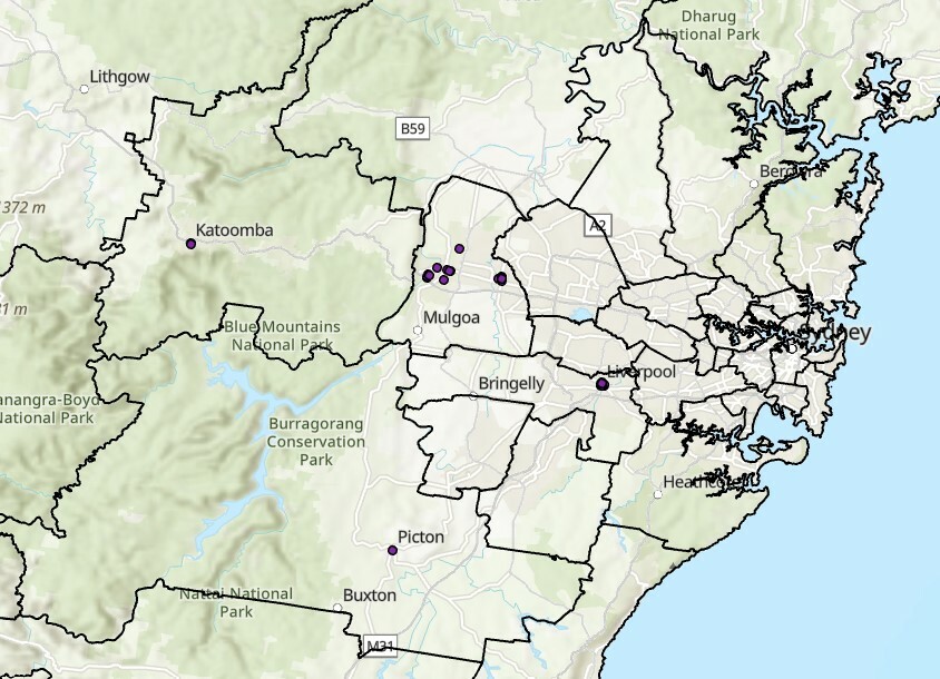
Hi all, I am trying to convert a CSV file generated from IoT censors to file GDB. The table got a geolocation field in which X and Y values were separated by comma. I wanted to get the data on LL-GDA94 projection. Although I was able to create a feature but it was not projected properly and appeared out of map extent in ArcGIS. Can anyone help me with the script that I have added here? I am attaching the CSV also. Thanks in advance.

Solved
The conversion from CSV to fileGDB file failed to properly project the data- any idea why?

Best answer by markatsafe
@smfks911 Just replace your Reprojector with a CoordinateSystemSetter as suggested by @tomfriedl or simply set the CSV reader coordinate system to be LL-GDA94. Even though there is no geometry when the CSV is read, FME will honour that when you create the geometry.
I think you might be able to simplify your workspace by using an AttributeCreator to set the X/Y values from your AttirbuteSplitter list, see attached (FME 2021.2)
This post is closed to further activity.
It may be an old question, an answered question, an implemented idea, or a notification-only post.
Please check post dates before relying on any information in a question or answer.
For follow-up or related questions, please post a new question or idea.
If there is a genuine update to be made, please contact us and request that the post is reopened.


Login to the community
No account yet? Create an account
An FME Account is required to contribute
LoginEnter your E-mail address. We'll send you an e-mail with instructions to reset your password.