

I have a wiremodel describing 50000 roofs with polylines. I would like to generate surfaces/area objects for use in Esri products and later converting to sketchup as well. Ideally no manual steps in the process.
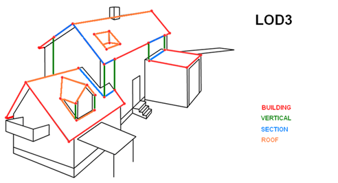
The model is described in this picture. (Black = reality, colors = existing data.)
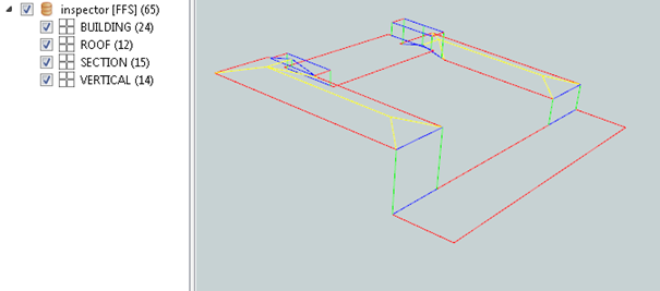
Here is a sample building.
I have solved generating the walls by finding lowest ground elevation and extruding the “BUILDING”-layer which make upp the building hull.
But how should I attack the rest?
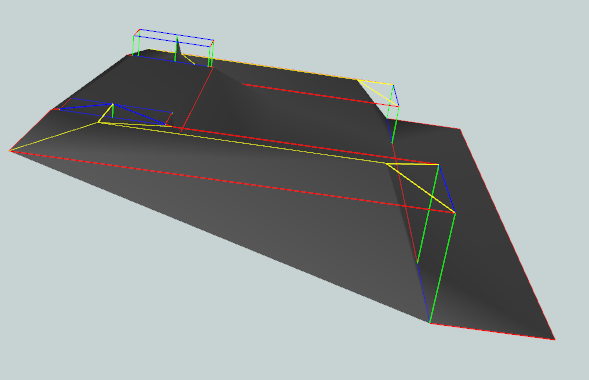
This picture show my attempt using surfacemodeller which im not sure about when it cant process the vertical parts of the roof, plus requires clipping afterwards..
Any guidance is much apprechiated!