Hi,
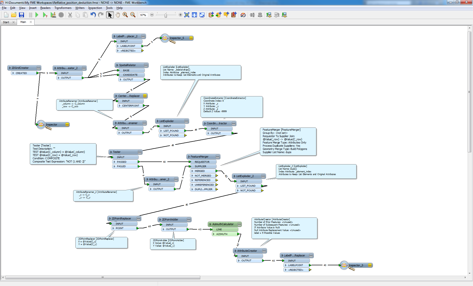
SpatialRelatro for starters, is ok.
Then CenterpointReplacer, name thes C_x and C_y.
Explode -relationships{}. Extract coordinates.
Use a tester to seperate Centerpoints (C_x,C_y) form the rest.
Merge the outputs form the tester, Centerpoints to suplier. Proces Duplicates and explode the duplicate list.
Now u have all points as centerpoints connected to their surrounding points.
Use 2DReplacer and 2DAdder to make lines.
Use AzimuthCalculator to extract angels.
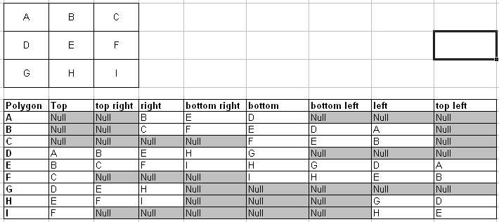
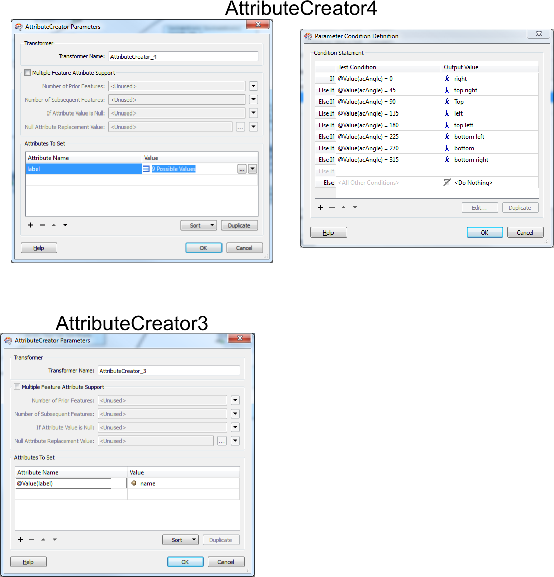
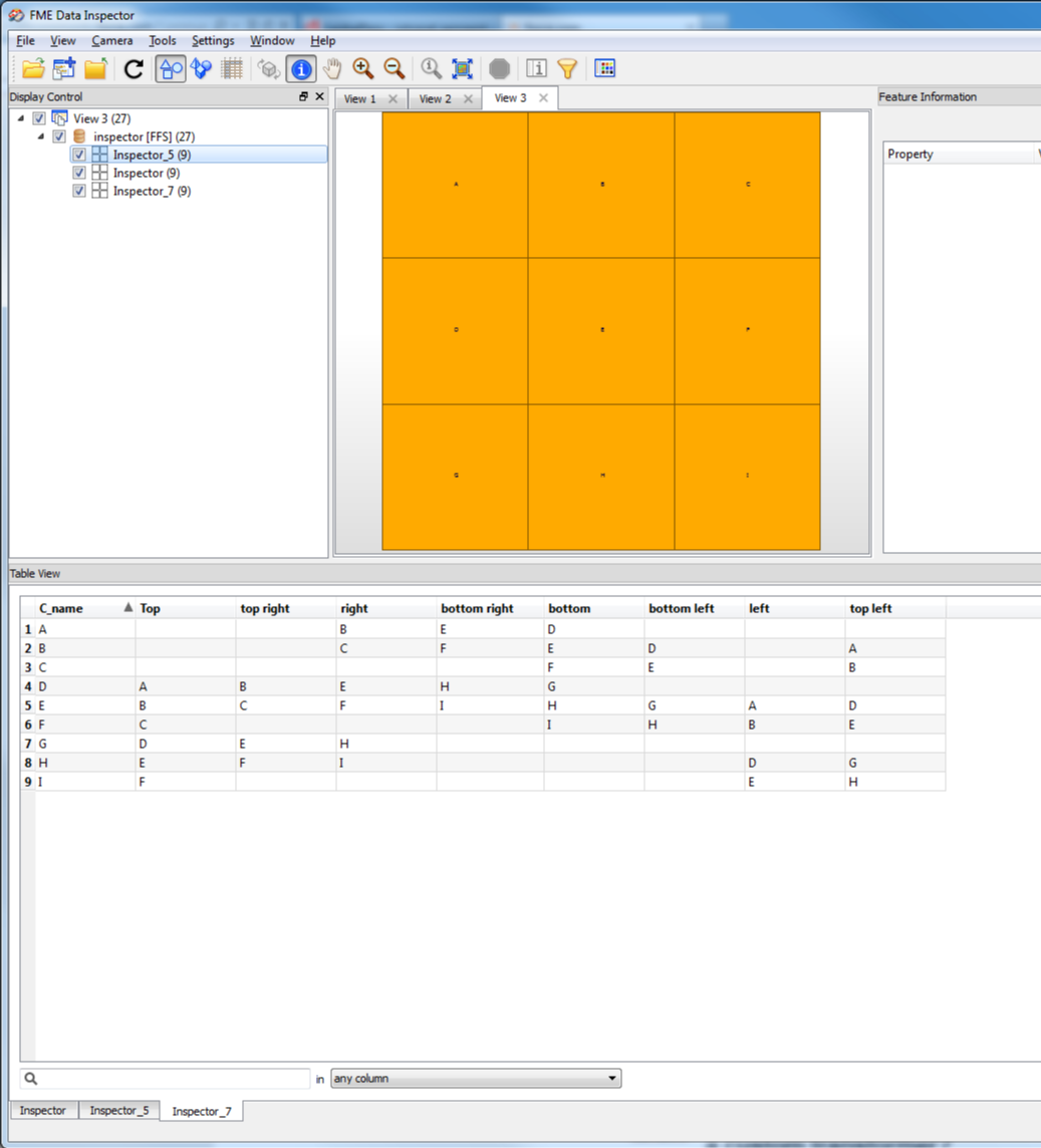
Make AttributeCreator in conditional mode to get the positional relations to create the table posted above.
Like for instance
if AcAngle = 90 then Topright= @Value(Objectname)
.
.
.
else do nothing
Here is a pic of the workspace
Haves Fun!
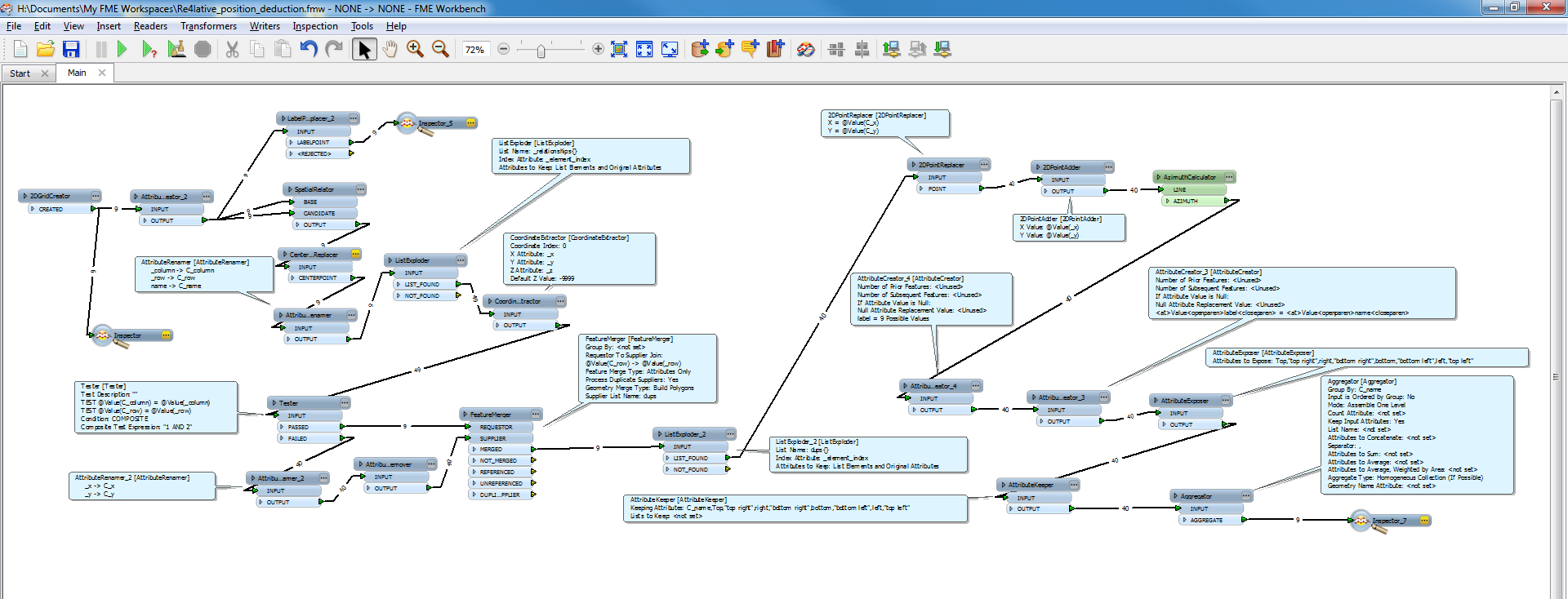
I have made a slight adjustment and also added the creation of your tabel:
Thi is the result:
ps.
attributeRemover prior to the FeatureMerger, removes attribute "name" from "centre" features.
In prior pic i forgot that one, wich messed up the coupling of the "name" attribute.
..erhmm..
erratum
i accidentaly switched left and top left in the Parameter Condition Definition.
180 is left and 135 is top left...
Hi,
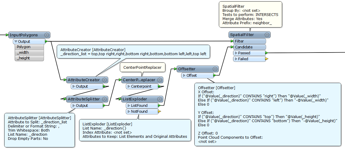
another approach. Assuming that every polygon has same sizes (width and height).
Step 1
Create 8 neighbor points for every polygon; give each point an attribute storing the direction name ("top", "top right", "right" ...).
Filter the points by original polygons; transfer the attribute storing overlapped polygon name to the point (e.g. "neighbor_Polygon").
Step 2
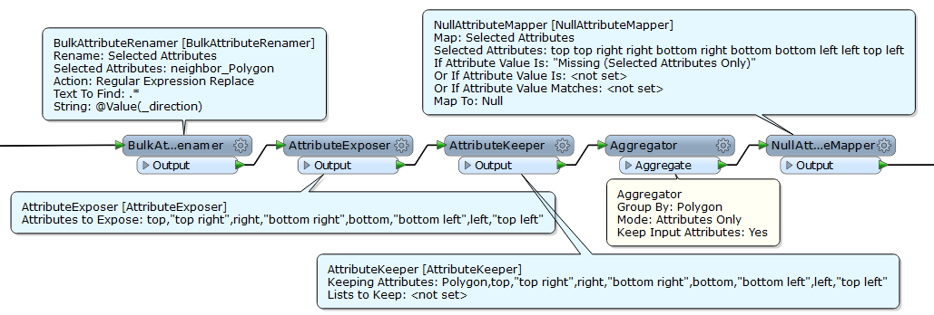
Rename the attribute ("neighbor_Polygon") with the direction name ("top", "top right", "right" ...).
Expose those attribute names.
Aggregate them grouping by original polygon name.
Replace <missing> attribute with <null>, if necessary.
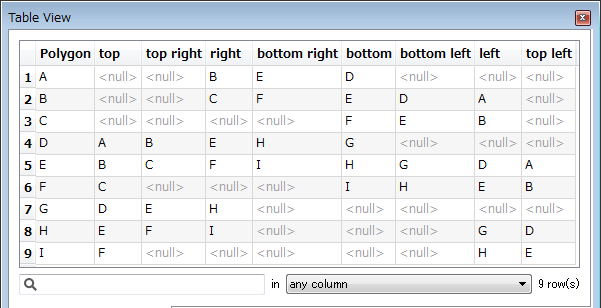
Result:
Takashi