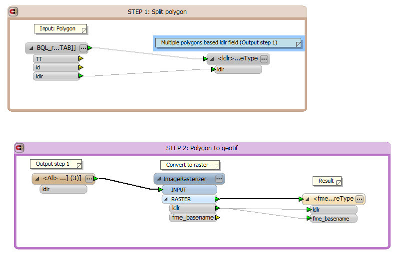
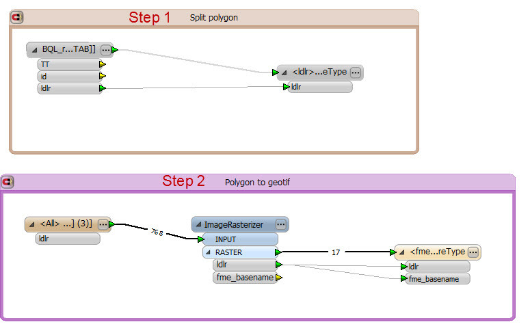
I have a polygon, I want to split based on a filed. Then, I want to convert polygons which is splited to raster (Geotiff) .
I tried it by two steps. But other method to do that only step? Can you help me? Thanks
This is myy solution:
This post is closed to further activity.
It may be an old question, an answered question, an implemented idea, or a notification-only post.
Please check post dates before relying on any information in a question or answer.
For follow-up or related questions, please post a new question or idea.
If there is a genuine update to be made, please contact us and request that the post is reopened.
If the reader in Step 2 reads all the data which were created by the writer in Step 1, you can send features read by the reader in Step 1 to the ImageRasterlizer directly, as I mentioned in the first post.
Yes. My figure done that look like you explain. But the step 2 will run when finish step 1 (It means I get output from step 1 to do input for step 2). Can I set up the processing when the step 1 finish and step 2 start run???
If the purpose is just to create raster data, you don't need to create the intermediate dataset which is being created with the writer (Step 1). Send the features read by the reader (Step 1) to the ImageRasterlizer directly, you can then remove the writer (Step 1) and the reader (Step 2).
Reader (Step 1)
|
+--> ImageRasterlizer --> Writer (Step 2)
But you can also remain the writer (Step 1) if you need the dataset that will be written by it. Just branch the data flow from the reader, and connect it to the writer (Step 1).