Question

How to convert "Heightpolygons" to a smoother homecontour

  • January 20, 2017
  • 5 replies
  • 65 views

jpdenboer
Contributor
Forum|alt.badge.img+2

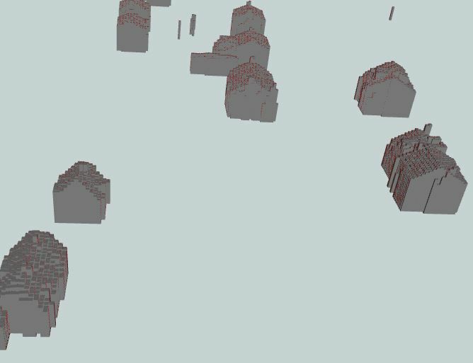
In this image you can see an contour of buildings made of polygons with a height. The contour of the buildings look like columnar basalt now. I want to make a smoother 3d contour of this buildings. Can you help me how to solve this?


This post is closed to further activity.
It may be an old question, an answered question, an implemented idea, or a notification-only post.
Please check post dates before relying on any information in a question or answer.
For follow-up or related questions, please post a new question or idea.
If there is a genuine update to be made, please contact us and request that the post is reopened.

5 replies

jpdenboer
Contributor
Forum|alt.badge.img+2
  • Author
  • Contributor
  • January 21, 2017
Is it possible to create a new polygon of the roof by a range of slope angles? Or is there a better way?


itay
Supporter
Forum|alt.badge.img+19
  • Supporter
  • January 22, 2017
Is it possible to create a new polygon of the roof by a range of slope angles? Or is there a better way?


Are these polygons generated from point cloud data?


redgeographics
VIP
Forum|alt.badge.img+63

It looks like you used a grid to represent the roofs. Have you tried generating a TIN and then clipping that to the building polygons? It'll still be a bit "busy" in some spots (especially buildings with different roof levels, like a church + tower, TIN is really bad at doing vertical lines) but it'll be an improvement over this.


jpdenboer
Contributor
Forum|alt.badge.img+2
  • Author
  • Contributor
  • January 24, 2017
Are these polygons generated from point cloud data?


These polygons are created from AHN2 data. (goeTIFF files)


itay
Supporter
Forum|alt.badge.img+19
  • Supporter
  • January 24, 2017
These polygons are created from AHN2 data. (goeTIFF files)


Ok in that case you can try using the pc and not the raster with the brand new PointCloudSurfaceBuilder transformer of FME 2017 RC, or as suggested build a tin.