

I have a shapefile of the road and I want to convert it into GeoTIFF But I want the GeoTIFF should show the road name

Question
How can you show an attribute of a vector file in GeoTIFF? (For ex- if I have to show the road name in the GeoTIFF file How can I show it)


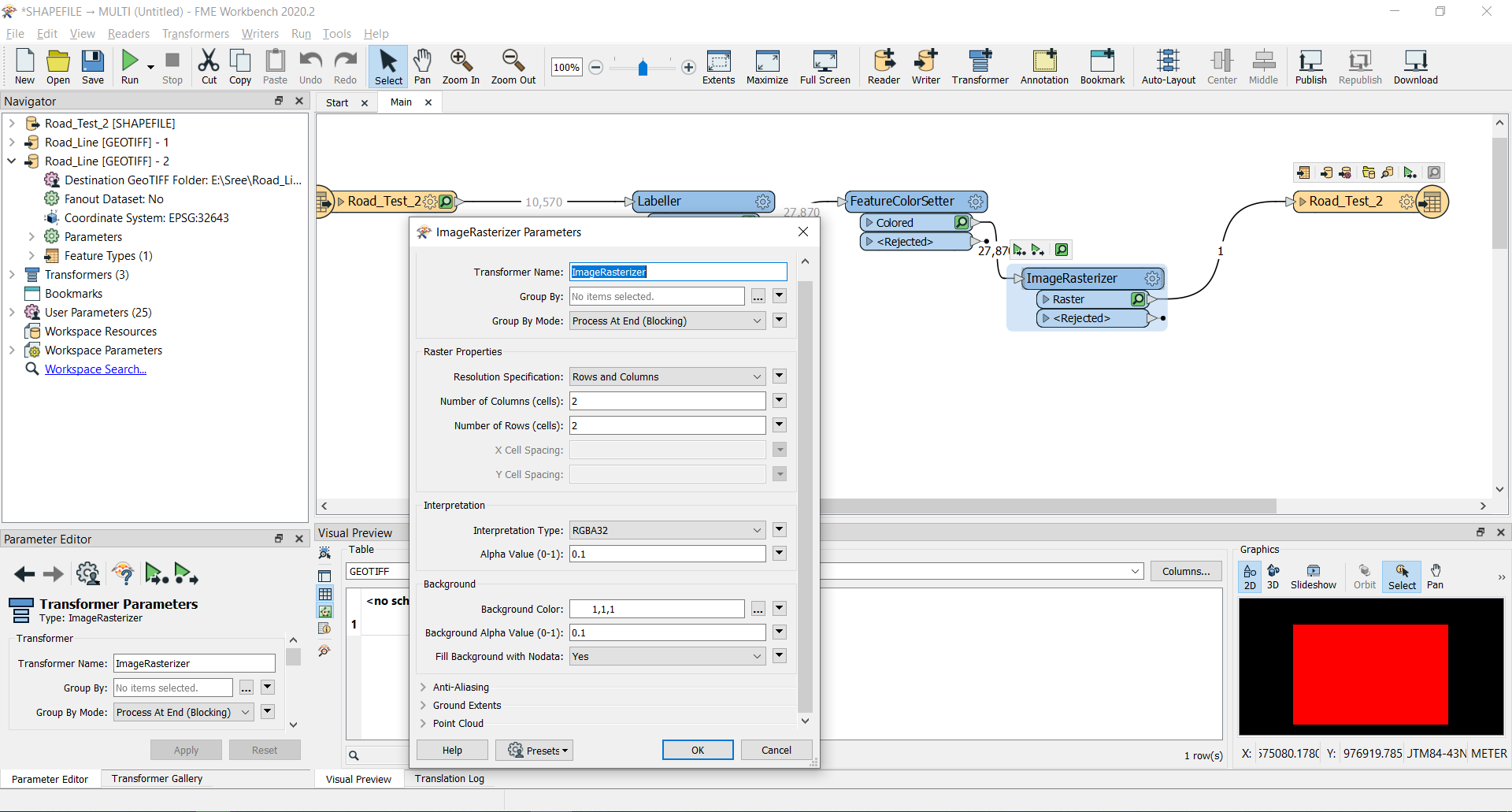 I have used it already but the result is not coming what I am expecting 😑
 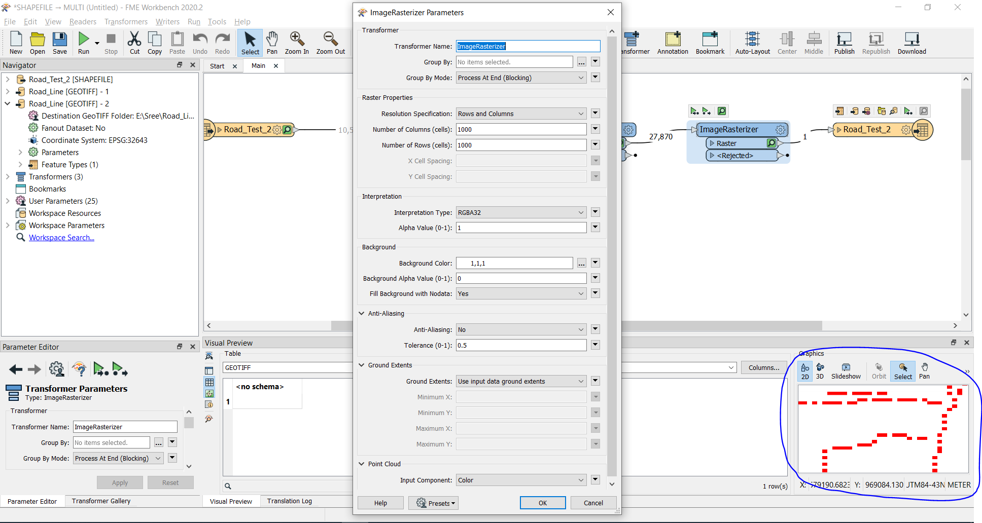 I have changed pixel size but the name is not coming. Do I need to add any other transformer?
Login to the community
No account yet? Create an account
An FME Account is required to contribute
LoginEnter your E-mail address. We'll send you an e-mail with instructions to reset your password.