Question

Converting CAD parcels to GIS in FME,

  • September 3, 2014
  • 8 replies
  • 50 views

jamal
Forum|alt.badge.img+5
Converting CAD parcels  to GIS in FME,


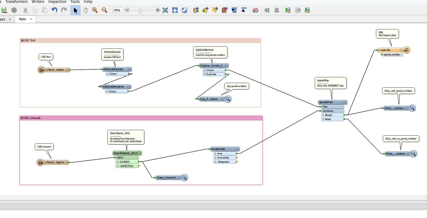
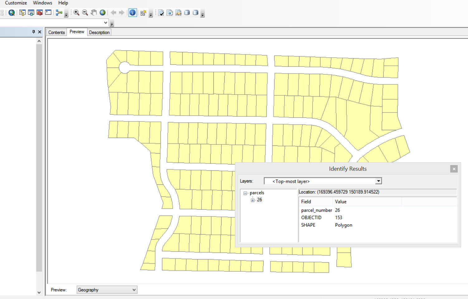
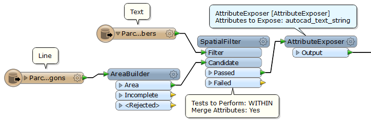
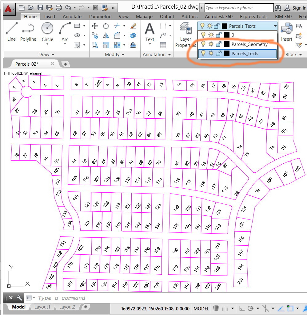
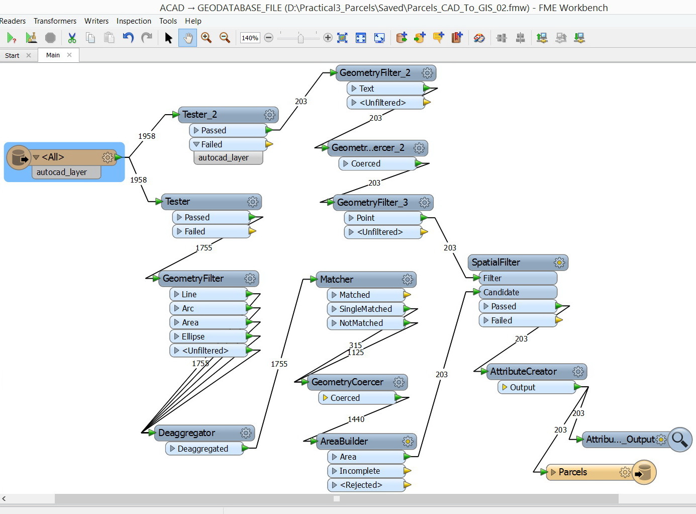
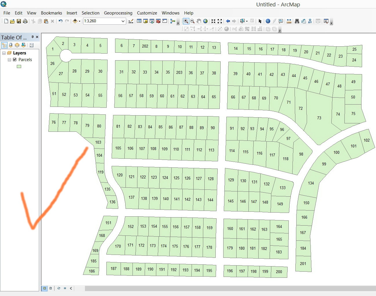
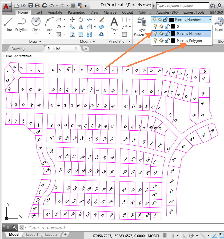
In ArcGIS, it is quite easy to convert parcels from CAD to GIS as shown in the model below. In CAD, parcels are drawn as lines inside which numbers are drawn.


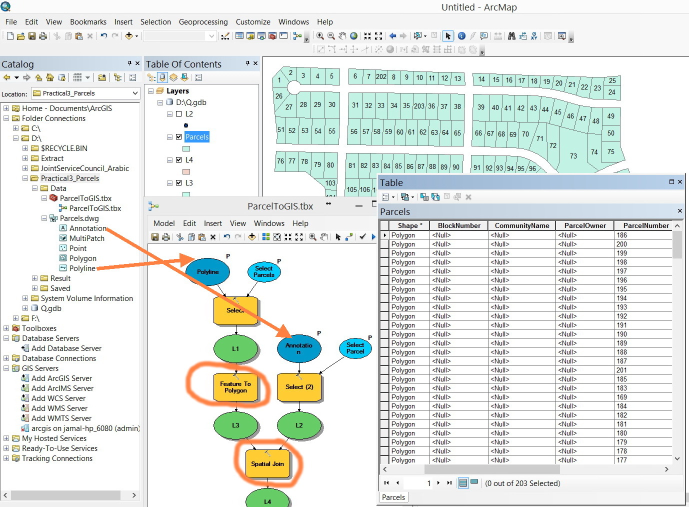
1. The lines are converted to polygons


2. The texts are converted to points that have text values as attribute


3. The texts are migrated to polygons by the command “spatial join”.


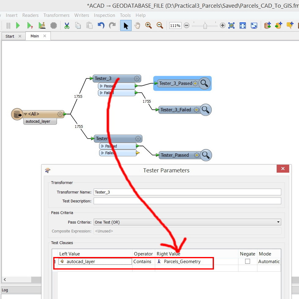
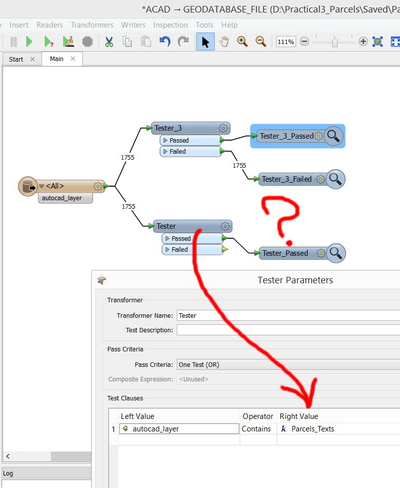
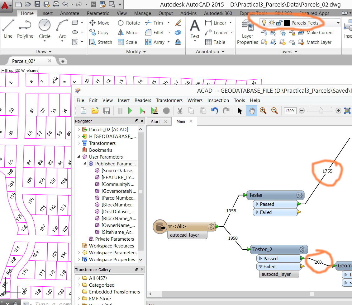
In FME, I couldn’t know how to


1. Convert lines to polygons


2. Convert text to points


3. Migrate text to polygons


How can I build an equivalent workbench to the model above?


Thank you


Best


Jamal
This post is closed to further activity.
It may be an old question, an answered question, an implemented idea, or a notification-only post.
Please check post dates before relying on any information in a question or answer.
For follow-up or related questions, please post a new question or idea.
If there is a genuine update to be made, please contact us and request that the post is reopened.

8 replies

Forum|alt.badge.img+1
  • September 3, 2014
Jamal,


See attached screendumps


Output in ArcGIS


SmartCleaner may come in handy - download from FME Store - not essential but useful.


Hope this gives u some ideas


............................


Regards


Howard L'


jamal
Forum|alt.badge.img+5
  • Author
  • September 3, 2014
Many thanks Howard for the help,


The screenshots are not clear. Could you please share the workbench itself?

takashi
Celebrity
  • September 4, 2014
In your case, it's quite easy also with FME. For example:


takashi
Celebrity
  • September 4, 2014
The essence of my data flow is completely same as Howard's suggestion. I think Howard's suggestion has more capability for some other dirty datasets.

Forum|alt.badge.img+1
  • September 4, 2014
Jamal,


In FMEpedia (or any) webpage, if image too small / difficult to read.........


Depending upon your browser.......


Right click on image - save image as - then view outside of the web page eg in photoshop etc


OR


Zoom in directly on web page (depends on browser) - with Firefox click <Ctrl +> on keyboard. Other browsers have similar zoom functionality


.............


Not possible to attach workbenches in FMEpedia unfortunately otherwise I would post it for you no problem. File type attachments are limited to images only


.............


Hope this helps


Howard L'

jamal
Forum|alt.badge.img+5
  • Author
  • September 4, 2014
Many thanks guys for the prompt help,


In my case, the CAD file has two main layers: Parcels_Geometry and Parcels_Texts


http://www.mediafire.com/download/doxp7pm0ozd1fh9/Parcels_02.dwg


I use the “tester” tool to catch these two layers first. It does catch the Parcels_Geometry layer but fails to do so for the Parcels_Texts.


Why the “tester” tool fails to catch content of the Parcels_Texts layer?


jamal
Forum|alt.badge.img+5
  • Author
  • September 4, 2014
Now, I’m able to extract these two layers with the tester.


Thank you

jamal
Forum|alt.badge.img+5
  • Author
  • September 4, 2014
Many thanks Howard and Takashi for the massive help. With your valuable input, I could build the entire workbench that converts CAD parcels into GIS format.