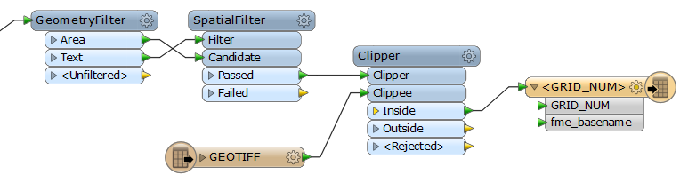
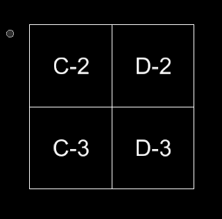
I am trying to clip a GEOTIFF using a V8 DGN vector grid (see below) and get the resultant tiles to have the grid square names (C-2.tif, C-3.tif, D-2.tif, etc.) but I just can't seem to figure out how to do it. The text and squares are on the same level in the DGN.
Here is the worflow I have going so far...
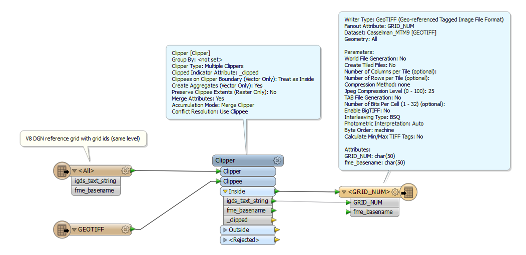
Any help would be greatly appreciated...
Thanks,
Bryan