")

Hi all.
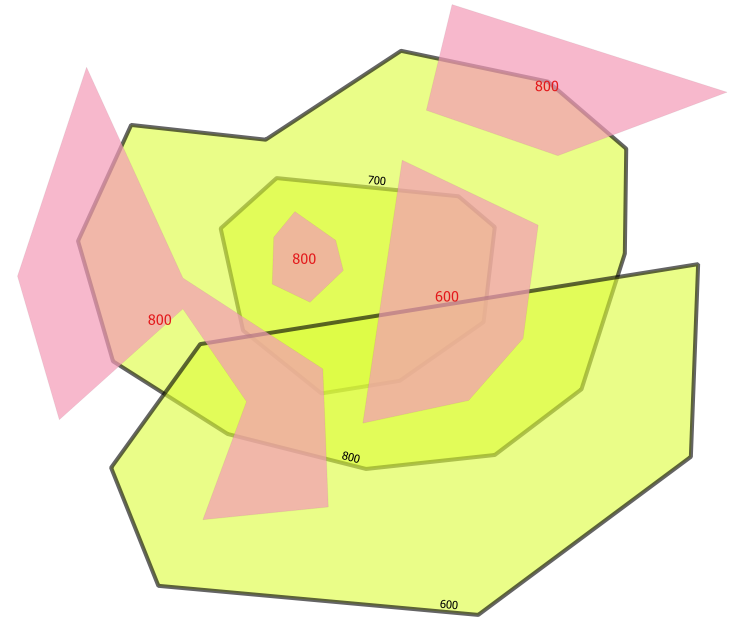
I Need some help. I have two ESRI shapes, the yellow one and a pink one.Both have a column named ID with the values shown below. The red label is for the pink areas and the black label belongs to the yellow areas.The yellow areas can completly be overlapped by each other. (area 800 is under area 700)
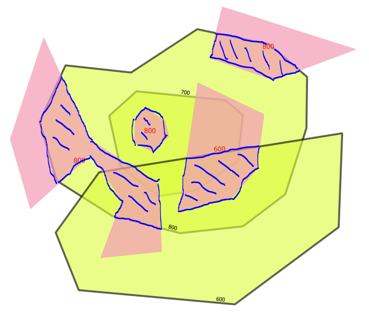
I want all to be "clipped" and joined between the pink and the yellow based on the ID column. I need the result as shown in the second image, the blue hatched resulting areas in a shape file.
Any ideas?