Question

Coordinate Systems Gallery - absent?

  • 2 February 2021
  • 3 replies
  • 6 views

Badge +9

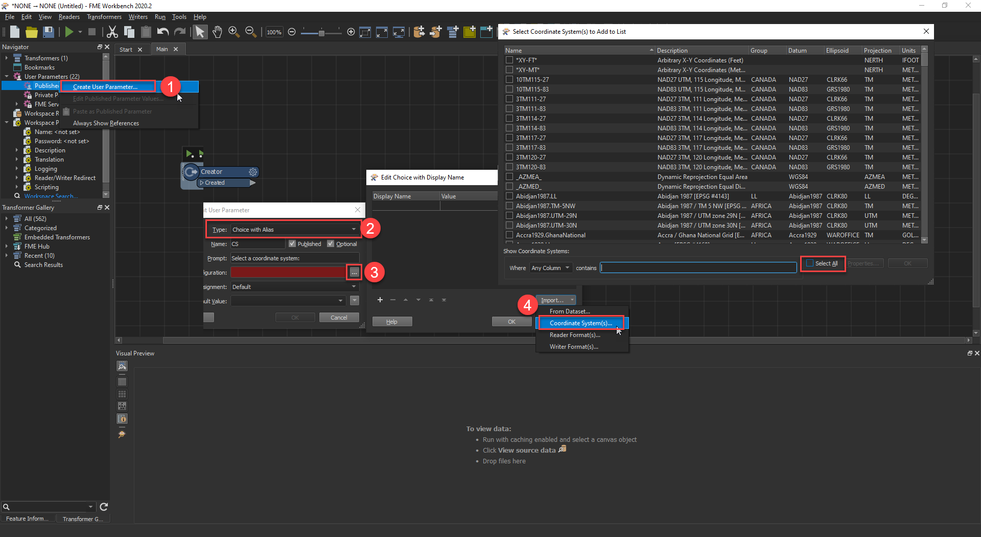
So I have a Coordinate System Name Parameter and in Workbench I get this nice gallery to help me pick and choose. There are several columns of data to use for searching or sorting...very nice indeed.

However now if I publish my workspace to FME Server, we get this:

CSgallery_missing
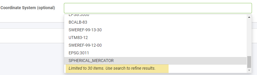
At this point the user would need to know what they're looking for, but without the metadata shown in the Gallery, you don't know exactly what you're picking especially if the end user is not a coordinate system expert (myself included!). For example I'd like to search for a UTM in meters, something in central US, etc. to ensure that any Lat/Lon coordinates are converted to something that makes sense for the picked area on a map.

Any thoughts? Should this be a wishlist idea? Thanks.


3 replies

Badge +2

Hope I'm not opening a can of worms here but... if you create a Choice with Alias parameter rather than using the COORDSYS parameter, you will be able to scroll through the entire list of values for that parameter in the server web ui (including on workspace apps). Server does not have the same coordinate system gallery and I'm not sure if this is something that is being considered. It would make a for great idea though, having a window similar to the geometry picker show up so you can select the coordinate system.


You may notice when using the entire list of coordinate systems in a choice with alias parameter it is rather slow to load the parameter values. I still believe it is a best practice to only include relevant coordinate systems to that workspace in the parameter value list but if you need to include more than 30 in that list, this is likely the best way.

2021-02-02_14-55-47

Badge +9

Thanks @chrisatsafe​ , that was something I thought about (didn't know you could import from the gallery directly though so thanks a lot for that tip!). My main issue is that I'm not really sure what CSs we would need and since the process I'm working on can be used for any site around the world, I thought of leaving the choice to the end user and if none is selected, I would reproject using the CommonLocalReprojector transformer instead since the original data is in LL84 but I need it to be in a projected coordinate system so it can be exported to DWG (accuracy of dimensions and angles in plan is most important). The areas for the most part could be as big as a whole downtown area.


With that in mind and since I am really no expert at this, what set of coordinate systems would you include in the choice list? Things could get compIicated with this approach as attributes in the original dataset are in metres (building height) so if someone reprojects using a system in feet, a conversion would need to be made. For example if I wanted to extrude some features for a project in the US that was going to be in Imperial units, heights would end up about 1/3 of their intended height without a conversion. I didn't see anything specific in the attributes after a reprojection that would indicate the CS units. Anyway, will definitely post the "CS Gallery on FME Server" idea and link back to it here 😃

Badge +9

Here's a link to the Ideas post: https://community.safe.com/s/idea/0874Q000000j0S7QAI/detail

Reply