Hi,
I am struggling with one simple task that is extracting information from wms and saving it as geotiff.
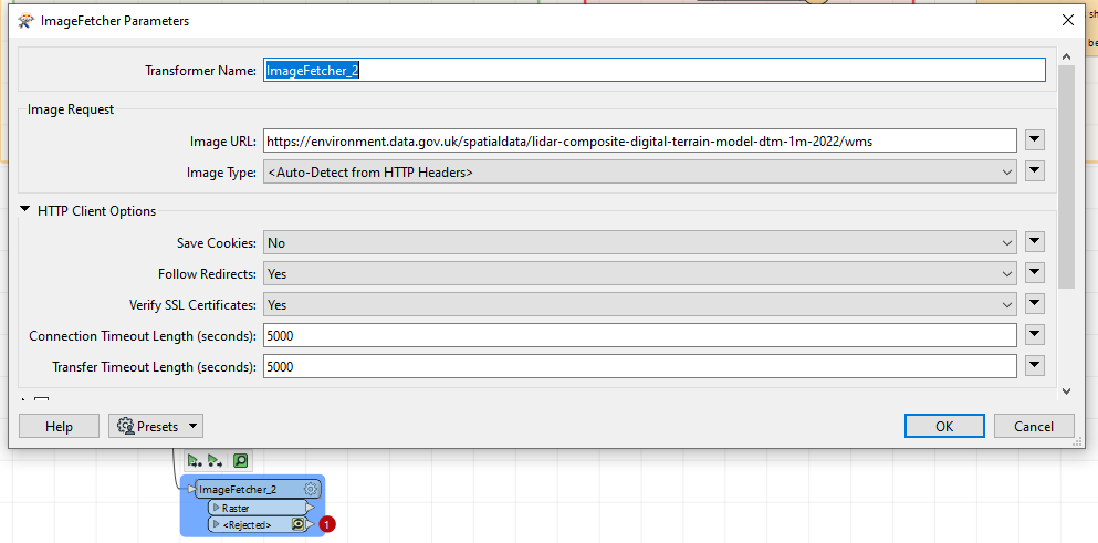
1. I would like to use HTTPCaller and ImageFeather to extract geotiffs from wms service https://environment.data.gov.uk/spatialdata/lidar-composite-digital-terrain-model-dtm-1m-2022/wms
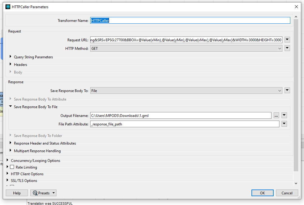
2 The URL of the wms should include BBOX=527389,177252,534694,181976&WIDTH=3000&HEIGHT=3000 to minimise the time to read the data
3. The geotiffs should be saved in Esri Geodatabase (File Geodb Raster Dataset)
Thank you for any help