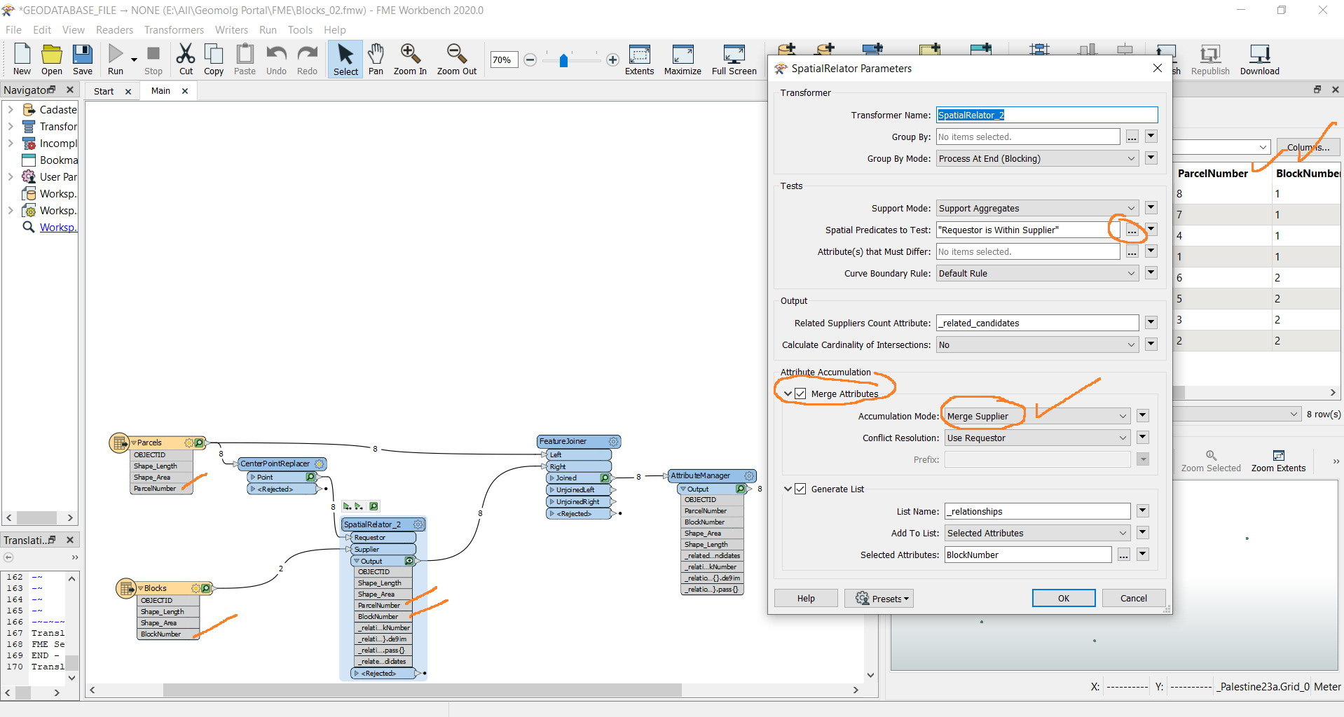

FME 2020: How to pass the Blocks number to their Parcels?
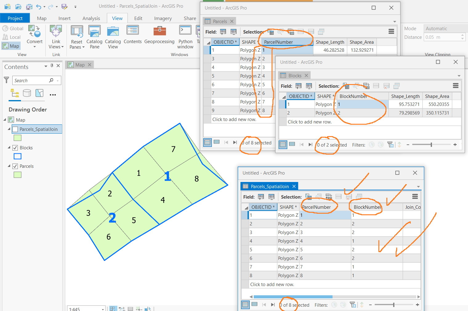
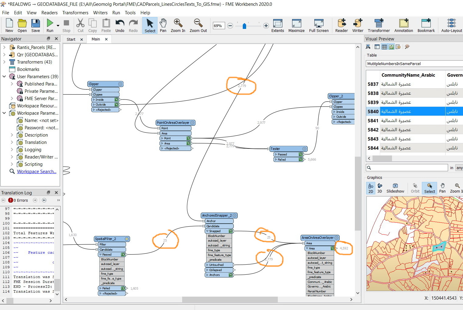
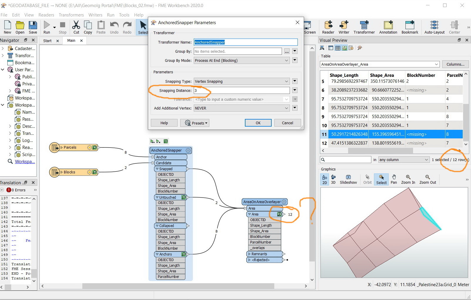
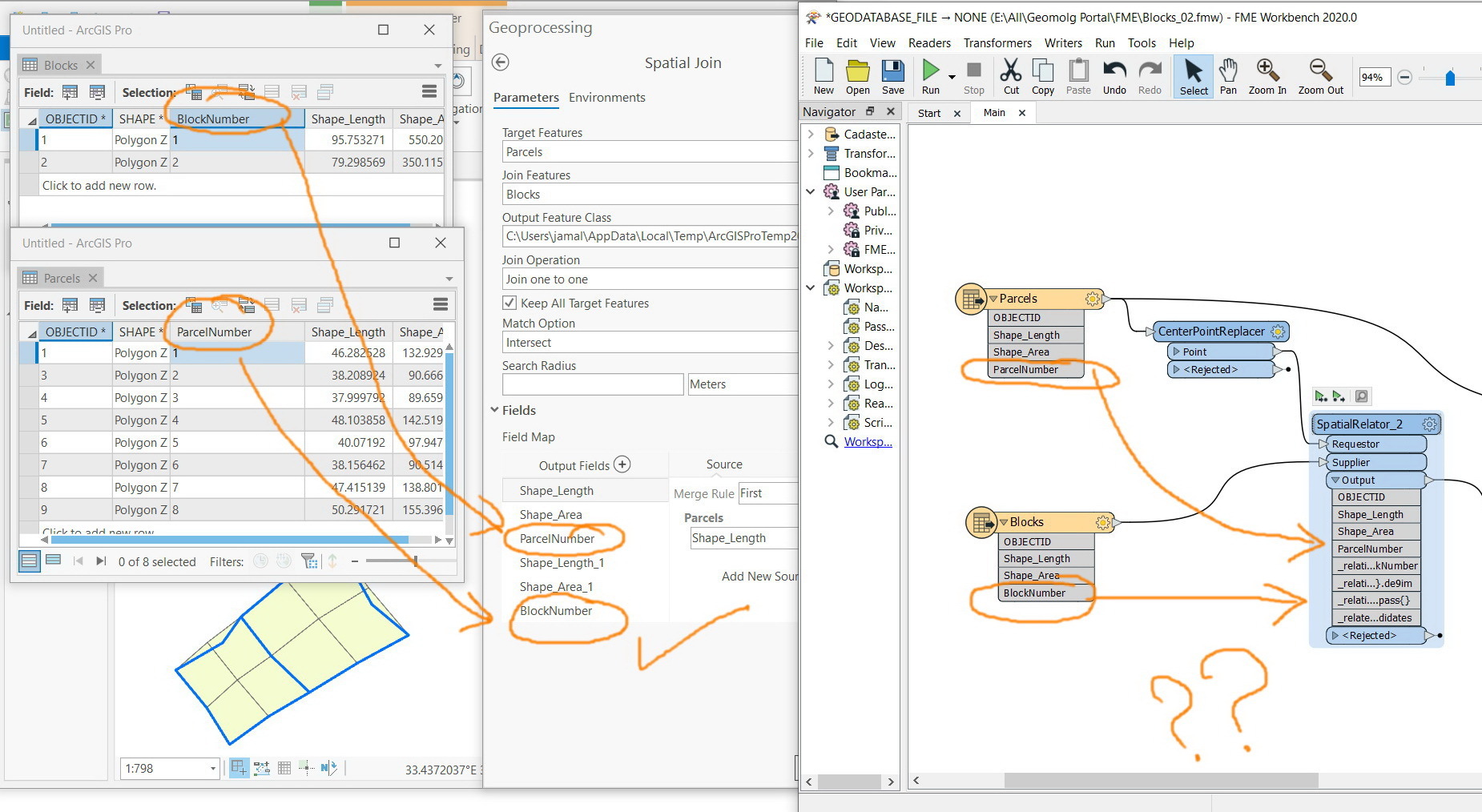
In the screenshot below, there are two layers: parcels and blocks. I wanted to pass the blocks number to all parcels contained in it to end up with a new layer that has two fields: parcel number and block number
What might be the best practice to perform this?
The data is attached


 We have a great
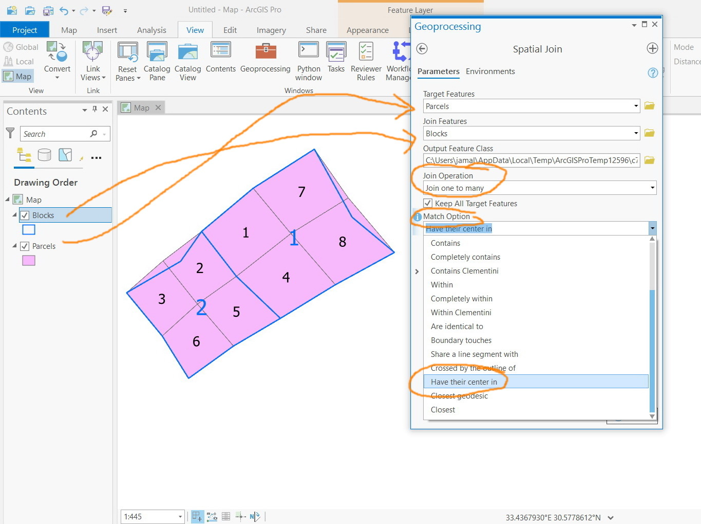
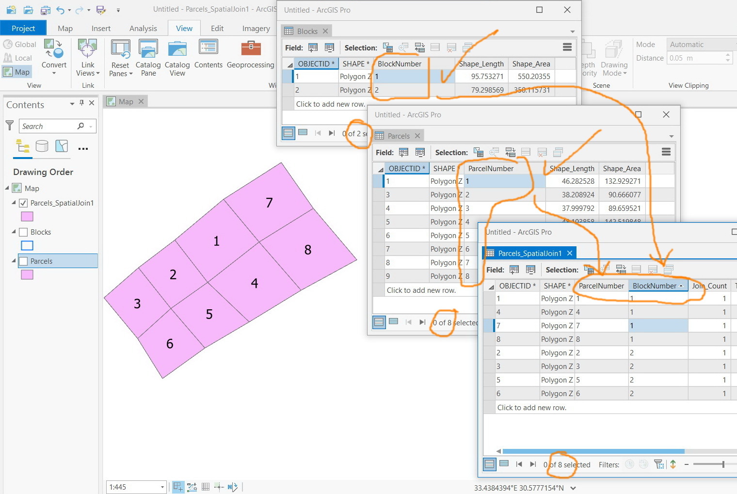
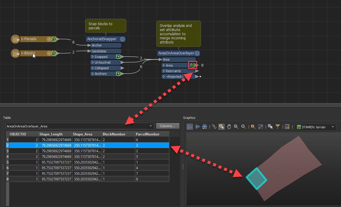
 It all depends on the
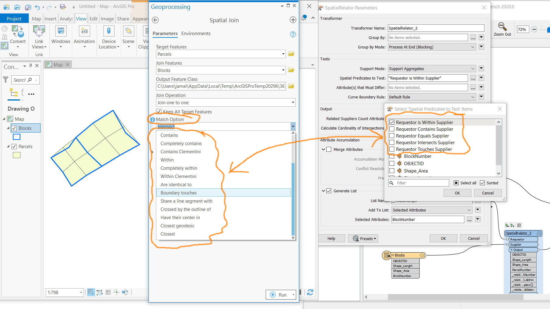
 I can't say whether all of the other match option types have been considered for the SpatialRelator, but you can likely produce similar results with other transformers (or a combo of transformers). If you'd like to see more match spatial predicates to test on in the SpatialRelator feel free to post the ones you'd be interested in seeing in addition to your use case as a