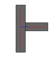
I would use a combination of Extender (set to "about your average road width"), Snapper and Intersector to achieve this, although that will potentially leave you with overshoots. They would be short lines with only 1 connection to the rest of the network (to distinguish them from actual dead-end streets).
Personally I would be very weary to accept the results as-is though, I would always want to take a good look at it for QA purposes and do manual edits when necessary.

