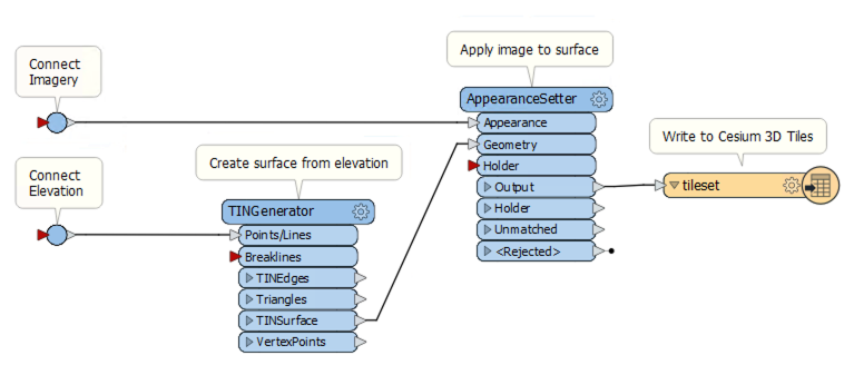
I only see that a couple of specific workflows are listed for conversion to 3D Tiles - these include Wavefront OBJ, CityGML, geojson, shp, and FGDB...
We would like to simply input raster imagery and elevation (geotiff for instance) and output 3D Tiles.
An example workflow that would be acceptable if supported:
- Raster geotiff imagery to TMS
- Raster geotiff elevation to TBD FME Mesh format most optimized for conversion to 3D Tiles
- TMS Imagery and FME Mesh to 3D Tiles (b3dm format)


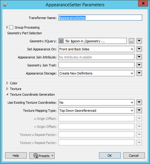
 In the AppearanceSetter, set the Texture Mapping Type to Top Down Georeferenced. This will align the image on the surface based on the georeferencing of the respective geotiffs.