image (1) I need to convert the polygonised raster and populate the raster value into the field category


features are inserted but not rendering

because there are too many

can you merge features with similar category

as in one multipolygon for each category

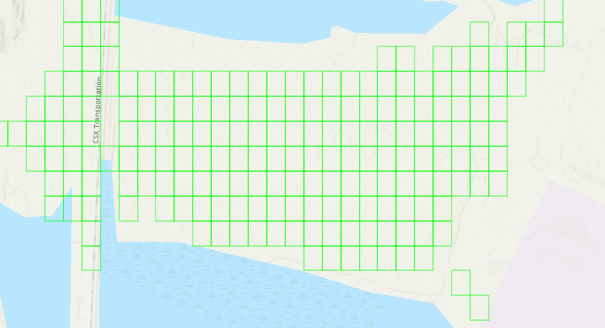
look at this image


it's like each pixel has been inserted separately as a record

this is wrong

adjoining features need to be merged as a single polygon

that way they will represent a single region


yes, I should have no more than (1000 Guess) features


any. one


Have you looked at the Dissolver transformer?


yes i did must still same problem


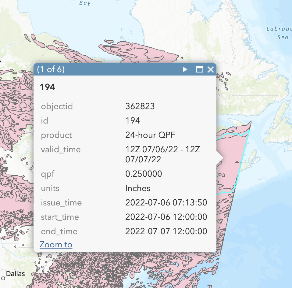
Currently, all the values overlap each other, I only need whatever layer/value has the highest qpf at any given location. See the attached screenshot as an example. This one shows at the location I clicked on there are 6 layers overlapping that location (1 of 6).3ae6d080-a68c-490a-b9e1-19144790fd1c


@asadamjad​ You could also look at using the Aggregator transformer and use the Group By parameter to group them by their Category attribute.


i did but same result i am getting


if you dont mind ccan you check please


To get the highest value at every location with overlapping polygons:

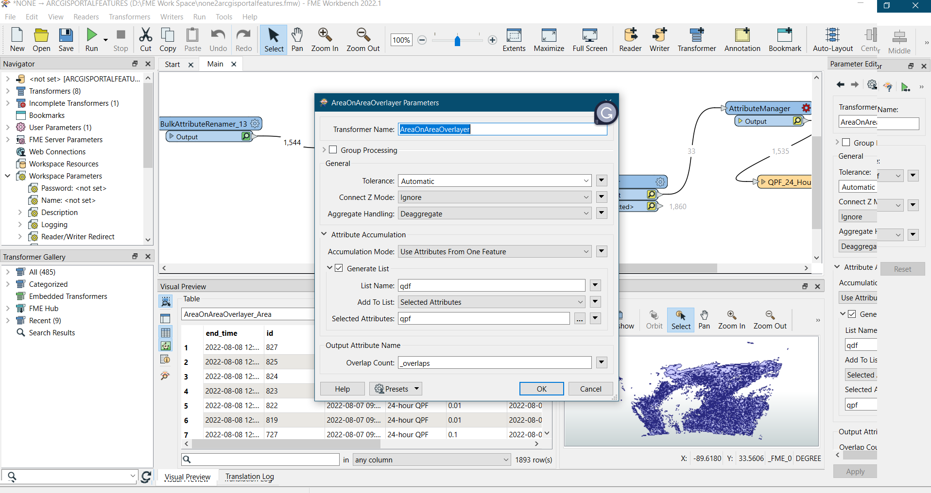
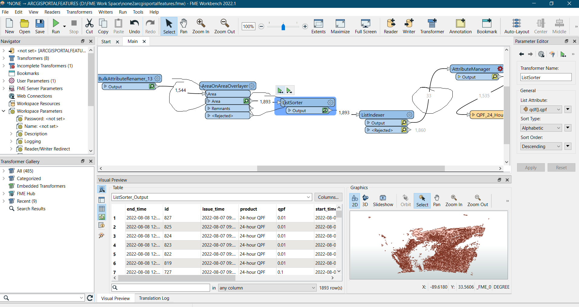
AreaOnAreaOverlayer, add all qpf values to a list.

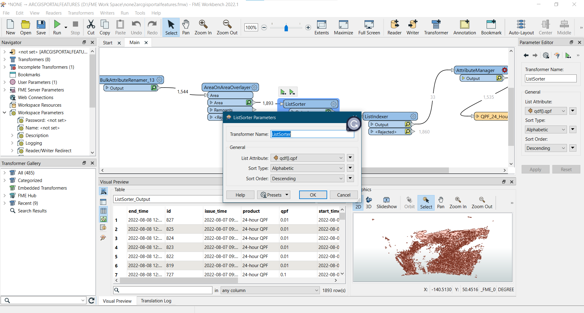
ListSorter to sort the list in numeric descending order (so highest value first).

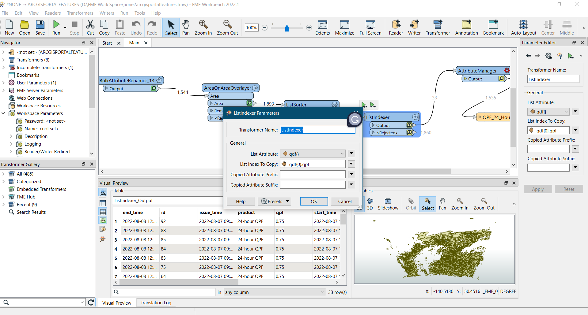
ListIndexer to get the value of listitem 0 (the highest value) into an attribute.


I get the result but in the end why its only 33 i need total what is in Source but in target its could b cliped 4321


can you check this file please


I get the result but in the end why its only 33 i need total what is in Source but in target its could b cliped 4321

@asadamjad​ there's a couple transformer parameters that need adjusting.

ListSorter: Set the Sort Type to Numeric

ListIndexer: Set the List Index To Copy to 0. This will return only the first index in the list


Reply