
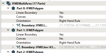
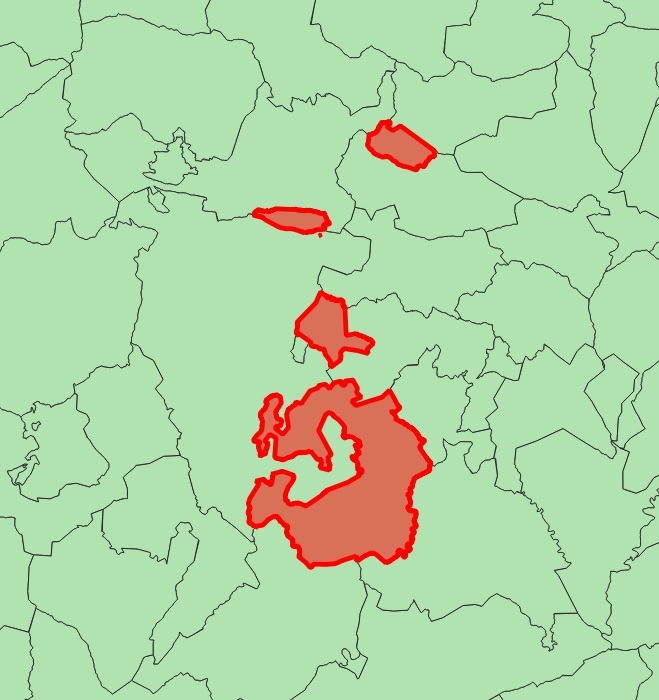
Hi! I'm using FME 2019.1 with INSPIRE Solution Pack and I'm trying to write an INSPIRE Administrative Unit GML from a shapefile (SHP) that contains some multipolygons. The problem is that the resulting GML does not contain the multipolygons geometries (but the features).

SHP (reader)


GML (writer)


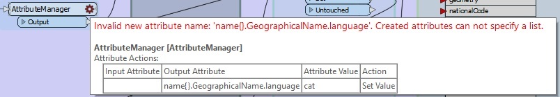
To assign values to the GML fields related to GeographicalName, I use 2 aggregators: one to generate the list "GeographicalName.spelling" and another to generate the list "name", both of them grouping by UUID.

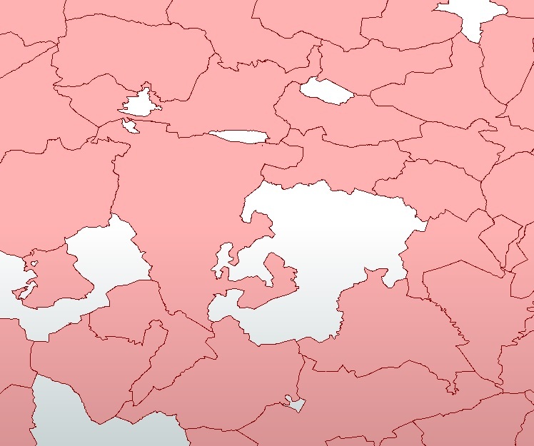
However, when doing the same (from the same SHP and using the same transformers) to write an INSPIRE Geographical Names GML, multipolygons are included.

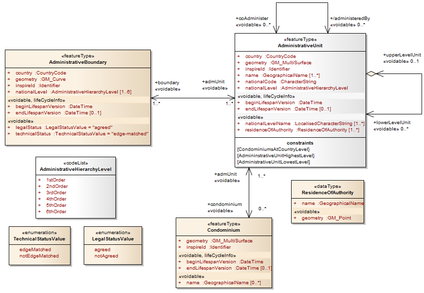
Is there maybe any issue with the INSPIRE Administrative Unit GML schema?

Comparing the resulting GMLs, Administrative Unit vs. Geographical Names, I see that the first one does not have a MultiGeometry tag.

Thank you so much,

Hi @dani ,

The geometry in the AdminstrativeUnit feature type in the Administrative Units INSPIRE schema is GM_MultiSurface, whereas the geometry for the NamedPlace feature type in the Geographical Names INSPIRE schema is GM_Object:

Source: https://inspire.ec.europa.eu/data-model/approved/r4618-ir/html/EARoot/EA2/EA1/EA2/EA1/EA7107.png

Source: https://inspire.ec.europa.eu/data-model/approved/r4618-ir/html/EARoot/EA2/EA1/EA6/EA2/EA7241.png


That means the geometry of the AdministrativeUnit is less tolerant, it has to be an aggregate. Make sure the geometry of those multipolygons looks like something like this in the Feature Information window of the FME Data Inspector:


Cheers,


Francisco

Do you actually have different features (i.e. geometries) for the different values of the attributes you want to set in the "GeographicalName.spelling" and "name" lists? If not you may as well use an AttributeManager to build the list manually instead of using an Aggregator. That way you wouldn't change the geometry


Do you actually have different features (i.e. geometries) for the different values of the attributes you want to set in the "GeographicalName.spelling" and "name" lists? If not you may as well use an AttributeManager to build the list manually instead of using an Aggregator. That way you wouldn't change the geometry

Hi @fgiron!

Thanks for the response but AttributeManager (nor AttributeCreator) do not seem to allow manual creation of lists (or I don't know how to do it properly).


Hi @fgiron!

Thanks for the response but AttributeManager (nor AttributeCreator) do not seem to allow manual creation of lists (or I don't know how to do it properly).

You have to set the list indices manually. The Output Attribute should be name{0}.GeographicalName.language


You have to set the list indices manually. The Output Attribute should be name{0}.GeographicalName.language

It works! Thank you so much


Reply