Question

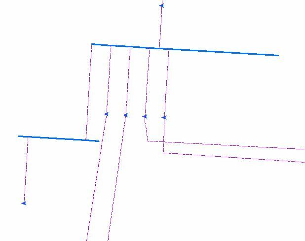
i have i esri map doc shown in the pic blue bold lines has complex edge geometry an e specefic id and blue triangular points has their own spec id now i want retive blue triangular points and bold line id into dashed lines

  • March 24, 2017
  • 5 replies
  • 39 views
This post is closed to further activity.
It may be an old question, an answered question, an implemented idea, or a notification-only post.
Please check post dates before relying on any information in a question or answer.
For follow-up or related questions, please post a new question or idea.
If there is a genuine update to be made, please contact us and request that the post is reopened.

5 replies

itay
Supporter
Forum|alt.badge.img+18
  • Supporter
  • March 26, 2017

For transferring attributes from one feature to another based on spatial relationships several transformers are available.

See the PointOnLineOverlayer and the SpatialRelator among others.

Notice the settings for the resulting lists

that contain the attributes of all related features.


Forum|alt.badge.img

For transferring attributes from one feature to another based on spatial relationships several transformers are available.

See the PointOnLineOverlayer and the SpatialRelator among others.

Notice the settings for the resulting lists

that contain the attributes of all related features.

i used spatial relator before , for example dashed line between two bold line at the output shows me that have two candidates related to it but i want to have both blue line id in the dashed lines fields now it retrive just one ids of blue line


itay
Supporter
Forum|alt.badge.img+18
  • Supporter
  • March 27, 2017
i used spatial relator before , for example dashed line between two bold line at the output shows me that have two candidates related to it but i want to have both blue line id in the dashed lines fields now it retrive just one ids of blue line


IF the lines are spatially related then both id's should be available, are you using the feature information window in the Data Inspector to inspect the SpatialRelator result? since the output will contain a list, this will not be visible in the Table View.


Forum|alt.badge.img

i used data inspector and i export the results to excel but just shows one id i think i should create two column for first id and second id or create a new row for second related feature


Forum|alt.badge.img

finally i founde it thanks for helps