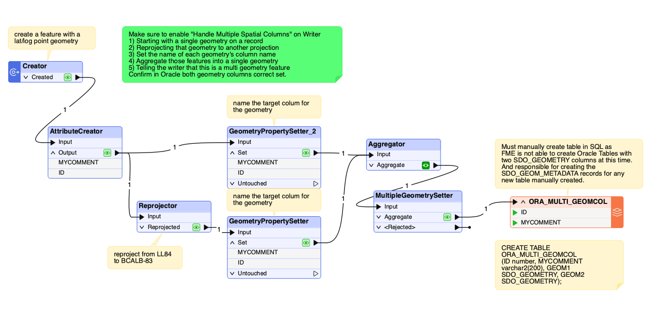
According to the documentation, the Oracle Spatial Object reader has an option to ‘Handle Multiple Spatial Columns’ (under 'Advanced’). If this parameter is set to Yes, feature geometry will be read into an aggregate. A parameter is set on the aggregate to indicate that each part of the aggregate is independent from the others, and its own geometry. Geometry parts of the aggregate are named and contain geometry according to their respective column in the table being read. You will probably want to deaggregate the geometries afterward.
As an alternative you can read attributes and one geometry column using SQLCreator or SQLExtractor.