
Hi all,

I am currently transferring existing As built drawing (.dwg) into GIS environment.

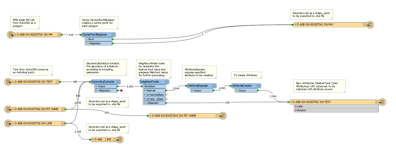
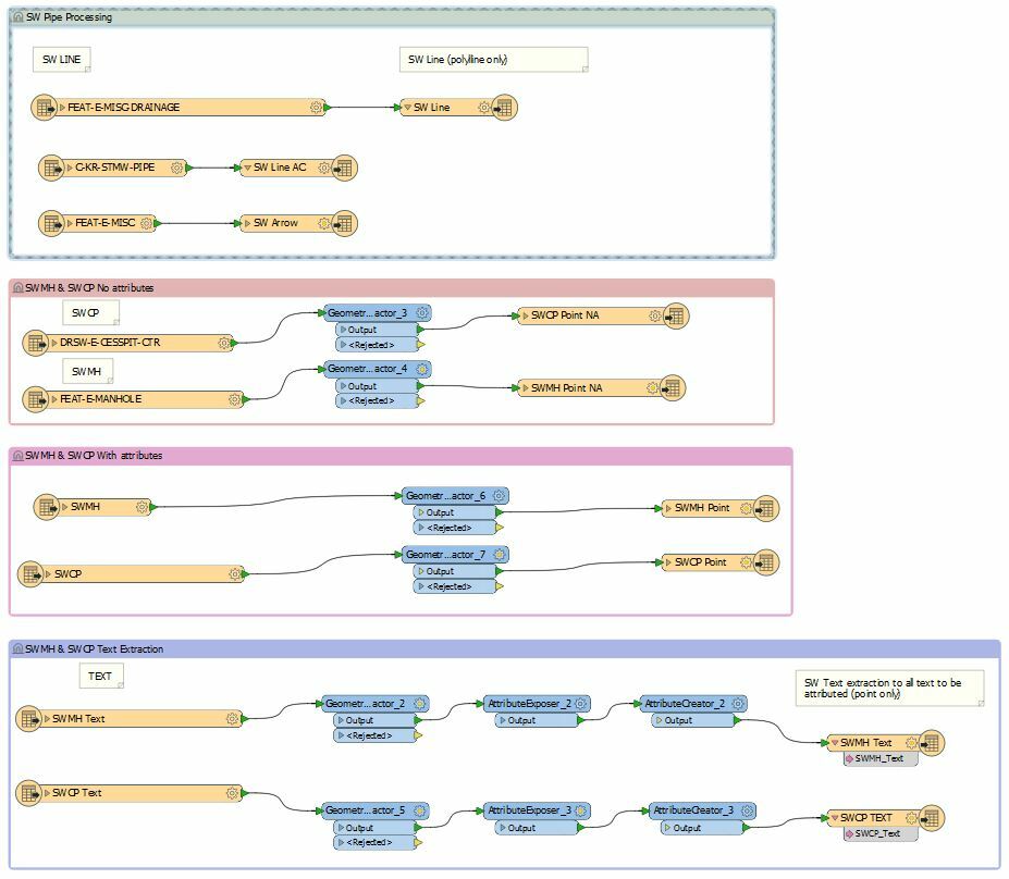
Workflow, that I decided to use consists of importing separate layers (from one drawing) and processing them individually. Also I created .shp files on output.

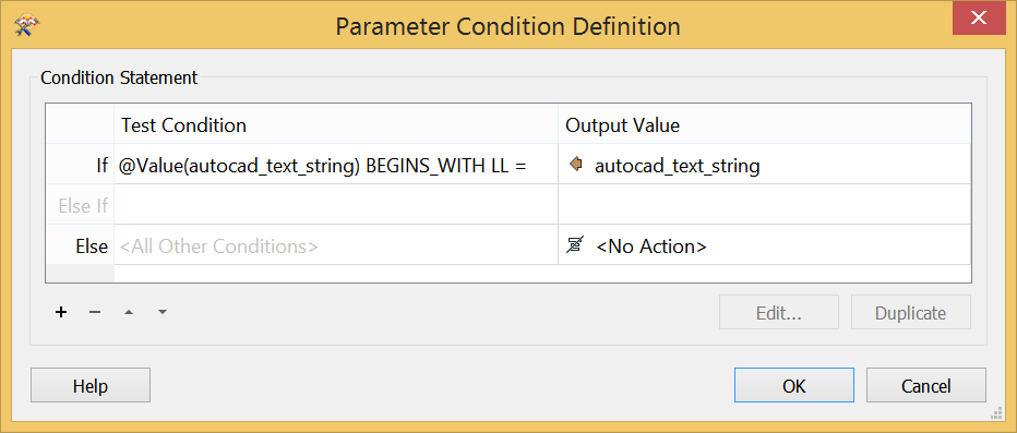
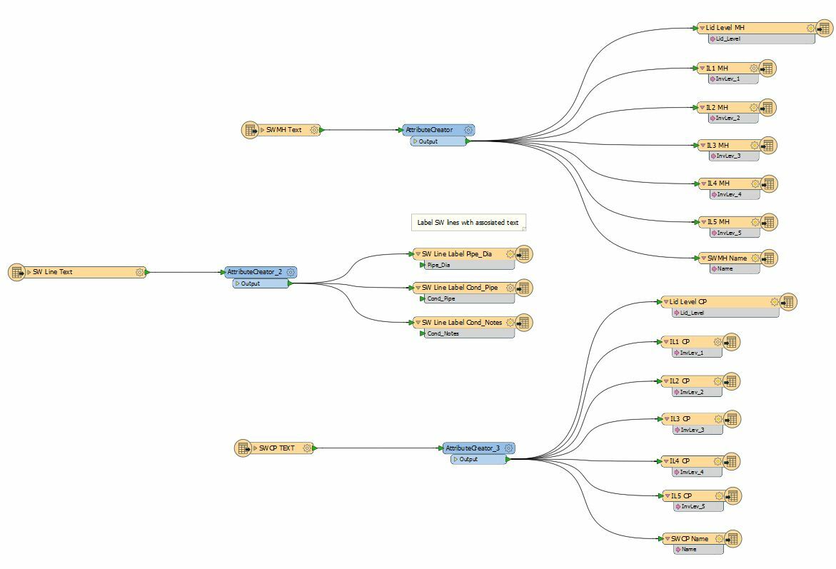
All necessary attributes stored in different layers as MText, so one of the shapefiles accumulates all text, I managed to create attributes Label (comes from autocad_text_string) and rotation (autocad_rotation).

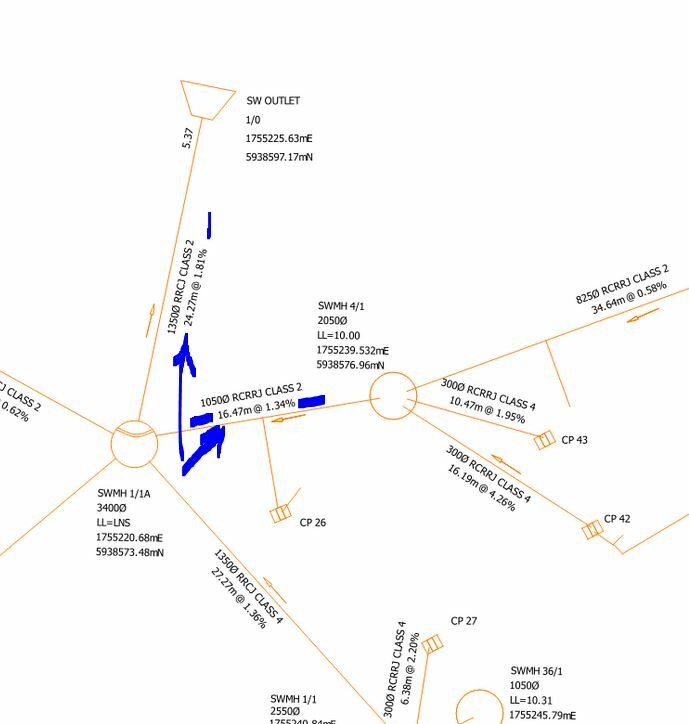
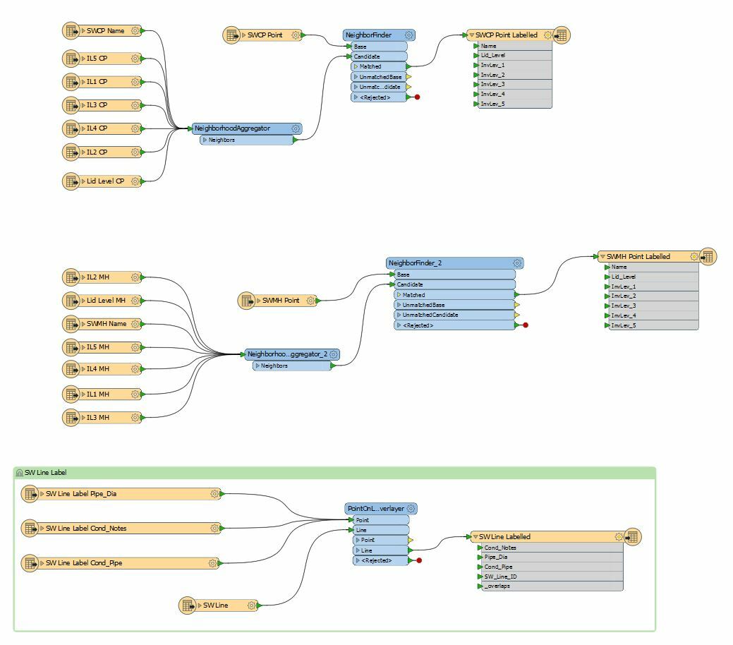
I am struggling to assign those separate text values to individual manhole or cesspit, as well as some of the blocks exploded into text and polylines (cesspit).

What is the best workflow to assign text, that derived as an individual point from MText to each asset, such as Manhole, Cesspit and Polyline?

Cheers

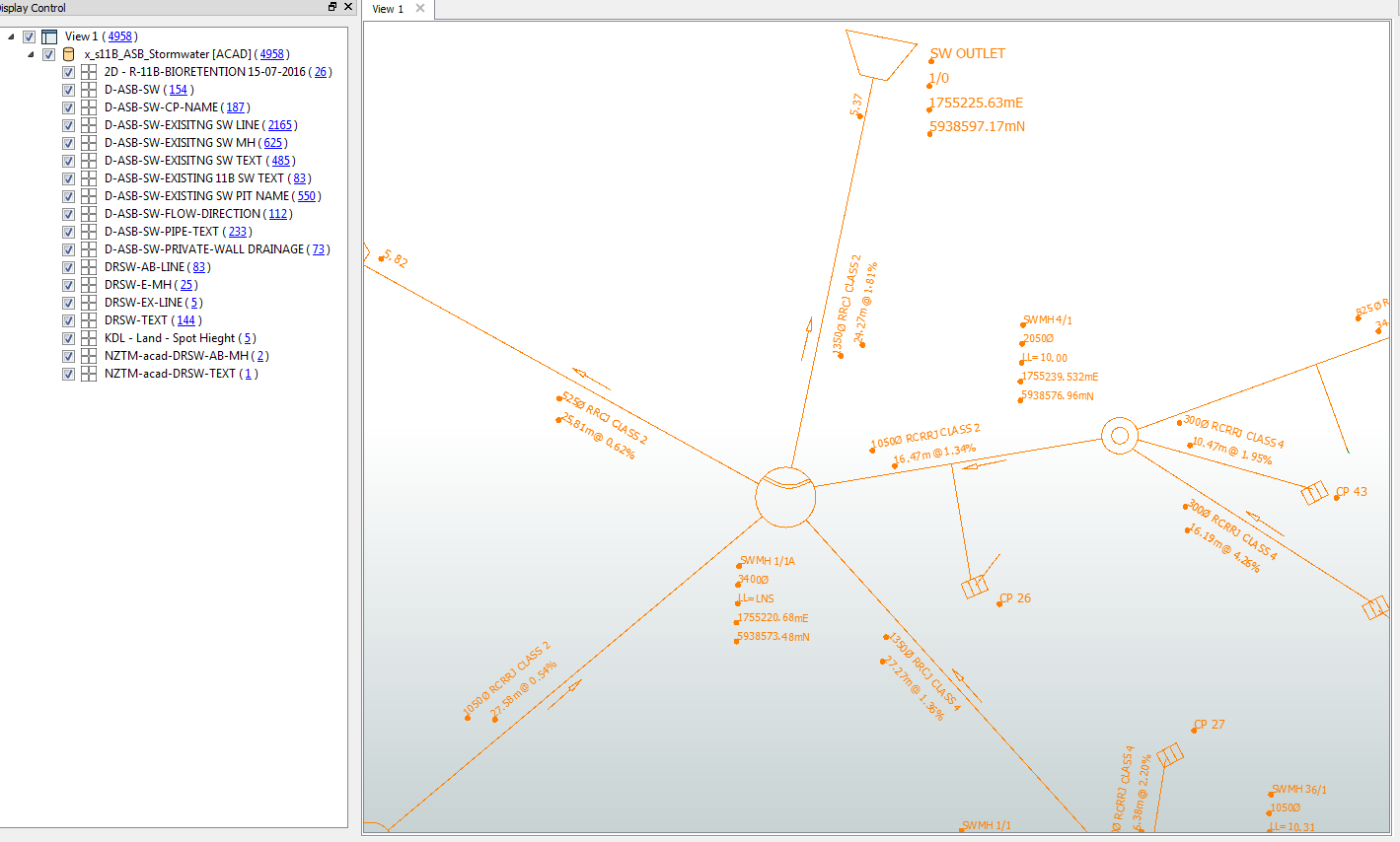
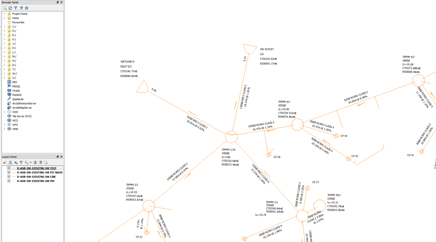
PS. Screeshot taken from QGIS shows labels only, that haven't been assigned to assets.

Hi @mkhovalko


please take a look at NeighborFinder - you might be able to use this transformer to find texts closest to assets to create attributes on assets. Another option would be to use Bufferer to create buffers... I guess around assets to 'catch' texts that overlap with buffers. If there are no strict rules in the original text placement and assets are close to each other, you probably won't be able to link 100% of texts to their assets - but with luck and good parameter values you will significantly reduce manual post-processing.


Hello @LenaAtSafe

thanks for your suggestion, I already used NeighborFinder to create attributes on desired assets, I will try to apply Bufferer as well. Is there any option of specifying, lets say "text, that starts with LL= should go to attribute "Lid Level" in output"?


Hi @mkhovalko,

I suggest you separate the data based on certain strings included the text such as "m @", "L=", "ME", "MN" .... I know it is tedious work but you won't have to recreate that all the time.

I would also if your work permits convert the Manwhole and Cesspits into polygons using the AreaBuilder.


To put the attributes (or the text ) into the polylines I still like to use PointOnLineOverlayer and PointOnAreaOverlayer but the choice is yours.

If you look at the picture below, the text position is not uniform so separating them into different attributes would be good.


I hope this helps,

Lyes


Hello @LenaAtSafe

thanks for your suggestion, I already used NeighborFinder to create attributes on desired assets, I will try to apply Bufferer as well. Is there any option of specifying, lets say "text, that starts with LL= should go to attribute "Lid Level" in output"?

You can do this with conditional values. The idea is to add AttributeCreator and attempt to create all possible attributes on each text feature, i.e. if the text starts with LL = it should get Lid Level attribute created and populated with autocad_text_string attribute value.


These attributes will later be merged on assets.


Please take a look at the attached workspace.


Hi @mkhovalko,

I suggest you separate the data based on certain strings included the text such as "m @", "L=", "ME", "MN" .... I know it is tedious work but you won't have to recreate that all the time.

I would also if your work permits convert the Manwhole and Cesspits into polygons using the AreaBuilder.


To put the attributes (or the text ) into the polylines I still like to use PointOnLineOverlayer and PointOnAreaOverlayer but the choice is yours.

If you look at the picture below, the text position is not uniform so separating them into different attributes would be good.


I hope this helps,

Lyes

@gisinnovationsb thanks for your suggestions! as a test I separated Lid Level per @LenaAtSafe suggestion and converted Manholes into Polygons. But the process of adding LidLevel labels to nearest Manholes is failing.


@gisinnovationsb thanks for your suggestions! as a test I separated Lid Level per @LenaAtSafe suggestion and converted Manholes into Polygons. But the process of adding LidLevel labels to nearest Manholes is failing.


Would you be able to share a subset of your data @mkhovalko


?
Would you be able to share a subset of your data @mkhovalko


?
@gisinnovationsb I managed to get it working just now, thank you!


@gisinnovationsb I managed to get it working just now, thank you!


Great to hear that, could you please share with us all, that would be beneficial to all (if you can 😉


Hi all,

Just to remind you, my task was to convert stormwater geometry and text into shp files by assigning attributes (kept as MTEXT) to features such as cesspits, manholes and pipes. As a result of trying and failing I managed to get somewhere. Basically I split this process into 3 stages:

1. CAD to SHP (extract geometry and text)

2. SHP to SHP (separate text with different attributes into different shp files)

3. SHP to SHP (assign attributes to required geometry features)

A little piece of advice would be to prepare your drawing by cleaning unnecessary geometry and text, as well as categorize required features into separate layers. I used layers when imported .dwg

If you have BLOCKS - explode them and retain points of insertion (in case you are planning to assign specific symbol to the point in your GIS application) - it makes easier to work with blocks. On other hand BLOCKS could contain attribute information, in this case you would have to treat them differently.


Reply