Solved

Please, does the image workspace convert citygml format to a shapefile?

  • 14 August 2022
  • 5 replies
  • 4 views

Badge

جدجديد
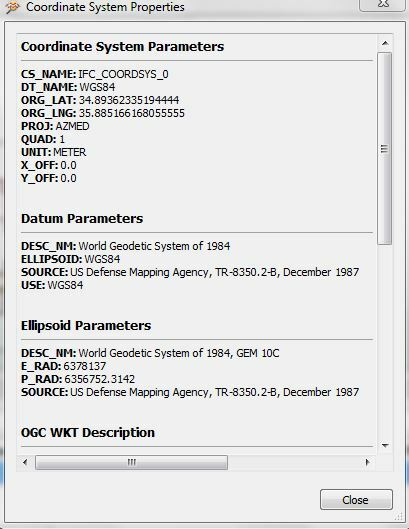
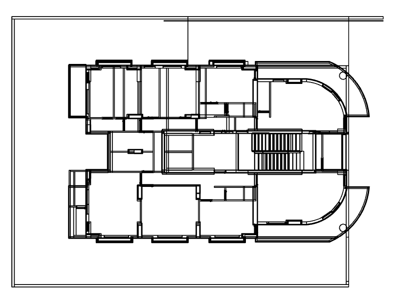
I have a file that has been converted from .ifc format to citygml format and I want to convert it to a shapefile. There is a problem with the coordinates and dimensions of the building. If the modeling is done, as shown in the following figure...Suggest me a set of solutions, please.?

icon

Best answer by evieatsafe 23 August 2022, 20:56

View original

5 replies

Userlevel 1
Badge +15

Hi @mohamdwassouf​ thank you for your question. Could you provide some sample data and perhaps we could assist you in your efforts.


From your photos, assuming that the left inputs are CityGML and the right outputs are Shapefile, it should run. However, you may need to check your attributes as they will be named differently in the Shapefile.


If you could also describe the problem you have with the coordinates and dimensions of the building, we can try to help with that as well.


Cheers, Evie

Badge

Hi @mohamdwassouf​ thank you for your question. Could you provide some sample data and perhaps we could assist you in your efforts.


From your photos, assuming that the left inputs are CityGML and the right outputs are Shapefile, it should run. However, you may need to check your attributes as they will be named differently in the Shapefile.


If you could also describe the problem you have with the coordinates and dimensions of the building, we can try to help with that as well.


Cheers, Evie

Thank you for your interest in helping me solve this problem

I'd like to convert this file from citygml to a shapefile with a location for the build on the map

Userlevel 1
Badge +15

Thank you for your interest in helping me solve this problem

I'd like to convert this file from citygml to a shapefile with a location for the build on the map

Thank you @mohamdwassouf​ for sharing your file.


looking at your file, I see that it does transform the CityGML to shapefile perfectly fine (with a few missing attributes as mentioned previously); however, even though it does have a coordinate system it does not seem to be georeferenced.

image 
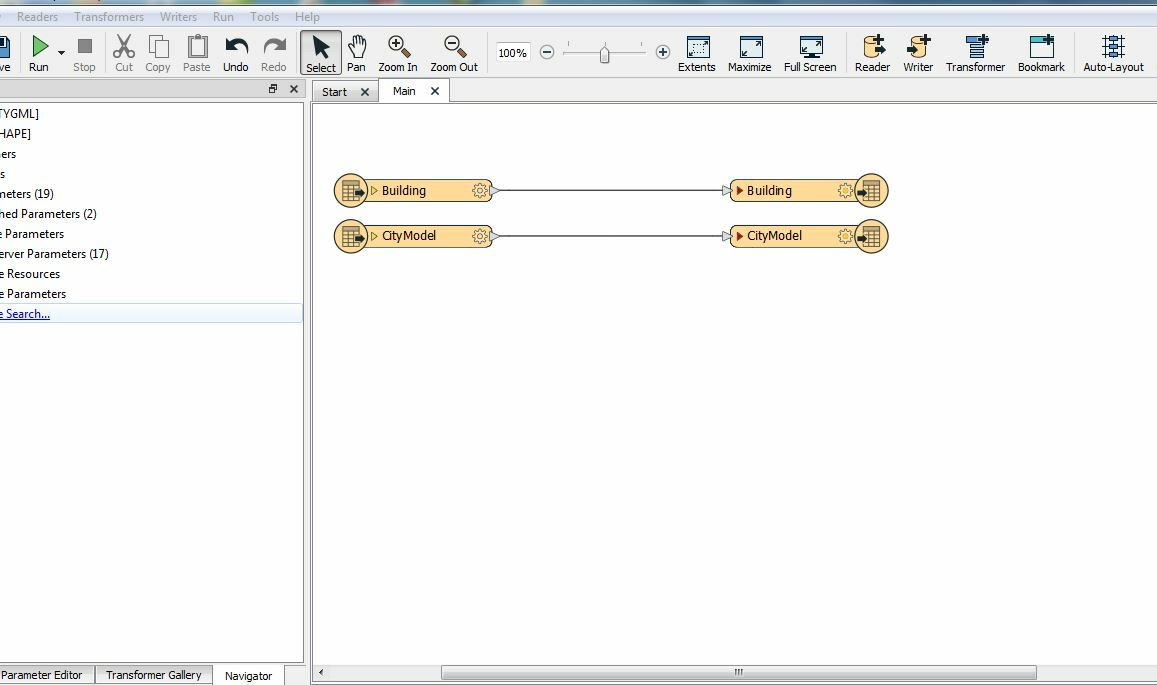
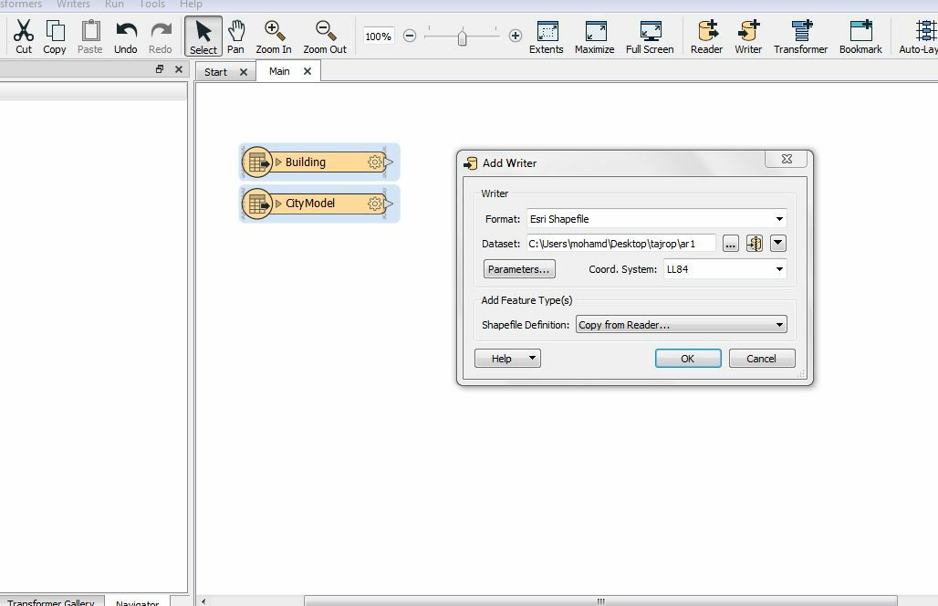
If you know where this building is supposed to be located, you can add this information manually in FME perhaps by using a combination of the GeometryReplacer, the LocalCoordinateSystemSetter, and the Scaler. Check out this article for more ideas on how this might be possible.

Badge

Thank you for your interest in helping me solve this problem

I'd like to convert this file from citygml to a shapefile with a location for the build on the map

Thank you very much for helping me with this problem

This is the .ifc file for the same building and it has a georeference but when converting it to citgml the location coordinates are lost

How can I keep it from being lost?3

Userlevel 1
Badge +15

Thank you for your interest in helping me solve this problem

I'd like to convert this file from citygml to a shapefile with a location for the build on the map

Hi @mohamdwassouf​ thanks for replying, where are you creating your IFC files? It seems that when the IFC files are loaded into FME it no longer has a spatial reference. I'm not sure if this is how you were transforming your IFC into CityGML, if you were using FME to do so this is likely the root of your issue.


Like I said previously, with the information of where this building is supposed to be located, you can add this information manually in FME perhaps by using a combination of the GeometryReplacer, the LocalCoordinateSystemSetter, and the Scaler.


If this is impacting your production and the article I provided does not help, I would suggest submitting a support case to have this resolved.


Cheers, Evie

Reply