Solved

Point coordinates cannot be infinite error

  • 18 September 2018
  • 10 replies
  • 14 views

Badge

Hello!

Once again, I've come across an error I have never seen before and can't find online.

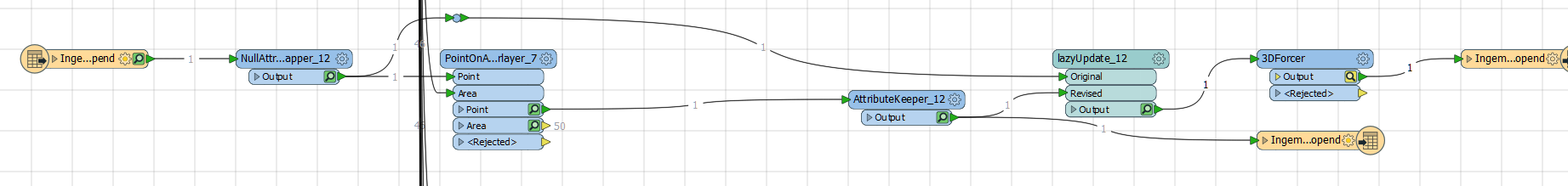
I'm adding a new ArcGIS Online feature layer to an existing workbench, which matches points inside polygons (using the PointOnAreaOverlayer) and gives the points the project number attribute from the polygon.

0684Q00000ArEFYQA3.png

This works fine for all the layers inside it, but this new layer gives the following error:

ArcGIS Online Feature Service Writer: 'updateResults' error for a feature in '<layerName>'. The error code from the server was '1000' and the message was: '24126: Point coordinates cannot be infinite or not a number (NaN).'

I checked the point which was sent to the layer (using the feature caching), it shows on the map just fine and according to the attributes it's an IFMEPoint. But at the end of the coordinates it shows <nan>, regardless of the X, Y and Z values.

0684Q00000ArEnyQAF.png


0684Q00000ArEPiQAN.png

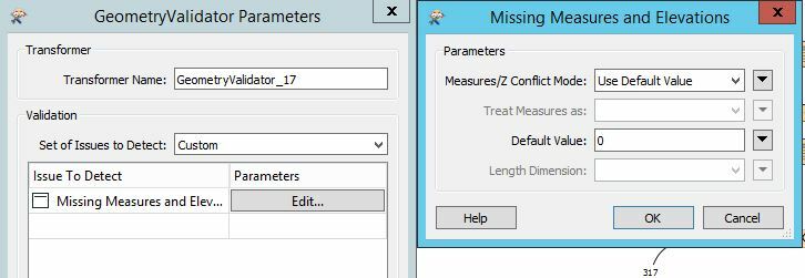
The main difference between this layer and the others is this one is the first with a Z-value attached. So I expect that's the problem. It also has the ESRI GNSS meta data fields, but I don't expect that to be a problem.


Things I have tried:
  • Specify the coordinate system on both the reader and writer
  • Add a 3DForcer transformer
  • Set the Z-value to a specific height, overwriting the existing Z-value
  • Removing and re-adding the reader and writer

The feature is routed to a geodatabase just fine.

How do I resolve this error?

Best regards,


Pijke

icon

Best answer by virtualcitymatt 18 September 2018, 11:55

View original

10 replies

Userlevel 4
Badge +26
Perhaps a screen shot of this? I'm curious about these 'nan' data


'I checked the point which was sent to the layer (using the feature caching), it shows on the map just fine and according to the attributes it's an IFMEPoint. But at the end of the coordinates it shows <nan>, regardless of the X, Y and Z values.'


Badge
Perhaps a screen shot of this? I'm curious about these 'nan' data


'I checked the point which was sent to the layer (using the feature caching), it shows on the map just fine and according to the attributes it's an IFMEPoint. But at the end of the coordinates it shows <nan>, regardless of the X, Y and Z values.'


I just added a couple of screenshots a few minutes ago. I pasted them when writing the post, but they didn't show up. They should be visible now.


Userlevel 4
Badge +26

OK my guess is that the 'measure' is causing the issue here. Use a MeasureRemover to get rid of it. the nan will be gone and if this is whats causing the issue you should be good.

Badge +10

The <NaN> probably applies to the m-values. Have you tried to only update the attributes and leave the geometry for what it is?

You could use the HTTPCaller and the ArcGIS REST API if it doesn't work with the AGOL writer

Badge

OK my guess is that the 'measure' is causing the issue here. Use a MeasureRemover to get rid of it. the nan will be gone and if this is whats causing the issue you should be good.

Omg, that worked! That you very much! Do you know what those "measures" are? What do they do?


Badge

The <NaN> probably applies to the m-values. Have you tried to only update the attributes and leave the geometry for what it is?

You could use the HTTPCaller and the ArcGIS REST API if it doesn't work with the AGOL writer

During the FME workbench the geometry doesn't get updated. I would rather use the FME writer instead of using the API directly, but that would be a possibility.


Toch bedankt!


Userlevel 4
Badge +26
Omg, that worked! That you very much! Do you know what those "measures" are? What do they do?


I don't really work with measures much, however, a think a big use is for storing the cumulative distance along a line. So called 'PolylineZM' Features? This is useful when working with networks and performing analysts on distances. Perhaps @DanAtSafe can expand on it? Or find an article where this is discussed.


Badge +10
Omg, that worked! That you very much! Do you know what those "measures" are? What do they do?


Measures are the values that are stored for Linear Referencing purposes. E.g. you have a table with a list a locations along a highway. Using those values and measure values along that highway, you can project the table features on the line.


Badge +8

In case your data is 3D(even with Z set to 0), please use 2DForcer and then MeasureRemover to resolve the issue.

I came across the same error message, loading set of shapefiles into ArcGIS Online. Unfortunately none of suggested solutions worked for me. Probably because I had different type of issue with the geometries.

What worked for me, was the GeometryValidator. The issue to detect was set to "Missing Measures and Elevations". For Parameters I used Default Value. GeoVal

Reply