
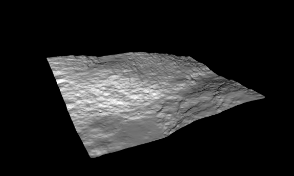
I need to do some interpolations to create nice terrain models for the architects at my office. The TINGenerator isn´t enough in this case. I tested a script in R that makes an idw interpolation. My input data is pointcloud lidar data and my output/end result in FME should be a vector surface to use in cad or sketchup. I am using the lidR library in R.
Should I make a raster output from RCaller first and then create a terrain model? Do I need more librarys in R? My R script is :
library(lidR)
las = readLAS("C:/R/win-library/3.5/lidR/extdata/Topography.laz") dtm1 = grid_terrain(las, method = "knnidw", k = 6, p = 2 )
plot3d(dtm1) The plot in the end wouldn´t be useful in this case
How should I apply the code in RCaller with pointcloud as input and vector terrain model as wanted output? Other transformers after the RCaller could be useful?
Tobias
Best answer by samatsafe
View original
